Complete weather awareness from days in advance to seconds before impact
AWA provides the strategic foresight through expert forecasts and private alerts
ZoneWatch delivers the tactical defense through hyper local proximity alerts
Zero weather blind spots for your daily planning and immediate physical safety
Seamless transition from human meteorological expertise to automated precision tracking
Maximize operational efficiency while maintaining absolute environmental safety
The Ultimate Weather Defense Scenario
ZoneWatch + AWA from early warning to all clear.
01
An AWA Advance Thunderstorm Notice arrives one day before a thunderstorm event.
02
This expert briefing allows you to confidently secure outdoor assets and reschedule critical plans well ahead of time.
03
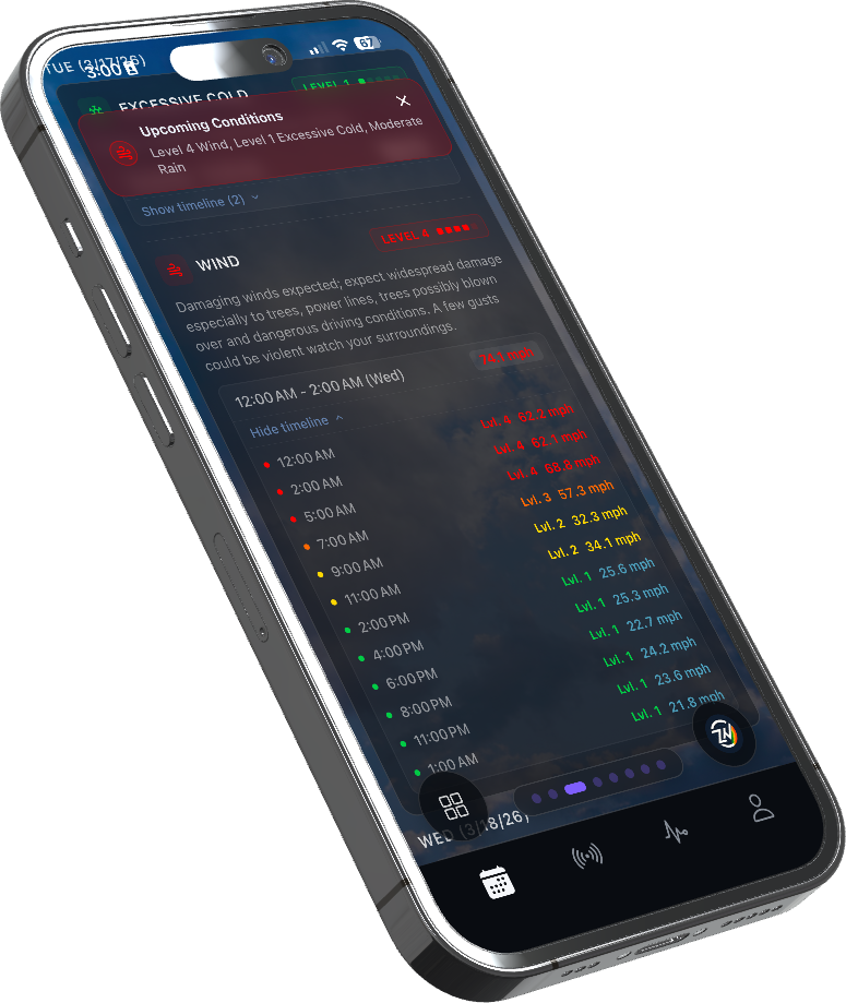
As the storm day arrives, ZoneWatch automatically takes command of your immediate physical perimeter.
04
You receive instant proximity alerts via push notifications the exact minute precipitation starts falling at your specific location and intensity.
05
Sudden dangerous wind speed changes and temperature drops trigger immediate real time notifications.
06
Second by second lightning detection warns you exactly when strikes breach your critical safety radius so you can seek shelter immediately, knowing when you are in the strike zone and when storms have passed in the clear.
07
Once the severe threat passes your radius, ZoneWatch provides minute by minute and hour by hour clearance updates so you can safely resume normal activities.
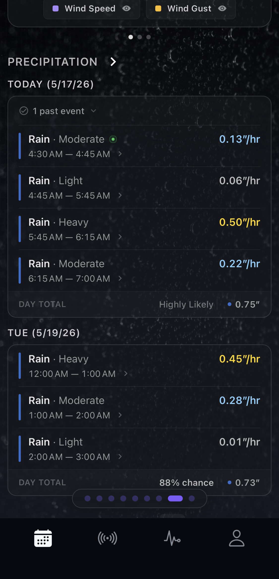
Saved locations
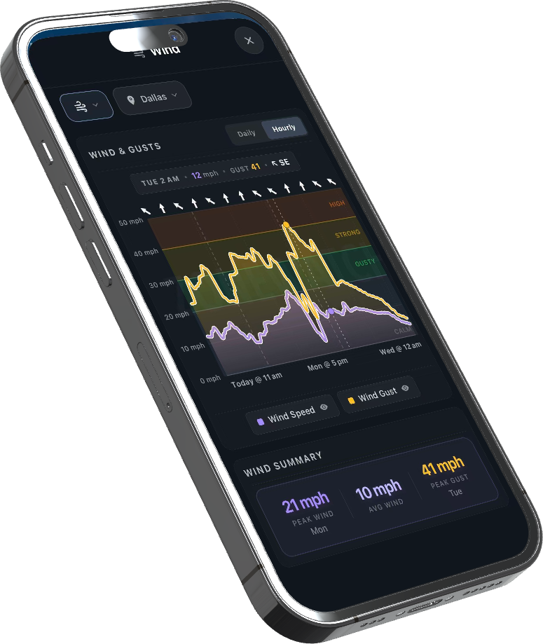
Hyper-local gust alerts
Minute-by-minute through hourly wind gust alerts tuned to your exact saved locations
Push alerts
Dangerous threshold pushes
Push notifications when gusts cross dangerous thresholds for outdoor work, travel, and events
Trend context
Hourly wind trends
Hourly wind trend context so you can see whether conditions are worsening or easing
Full stack
AWA + ZoneWatch stack
Combined with AWA advance notices so you plan ahead, then ZoneWatch defends the final mile
All clear
Clearance messaging
Clearance messaging when winds fall back into a safer range for your perimeter
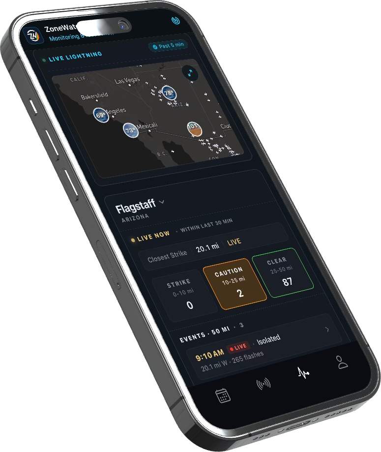
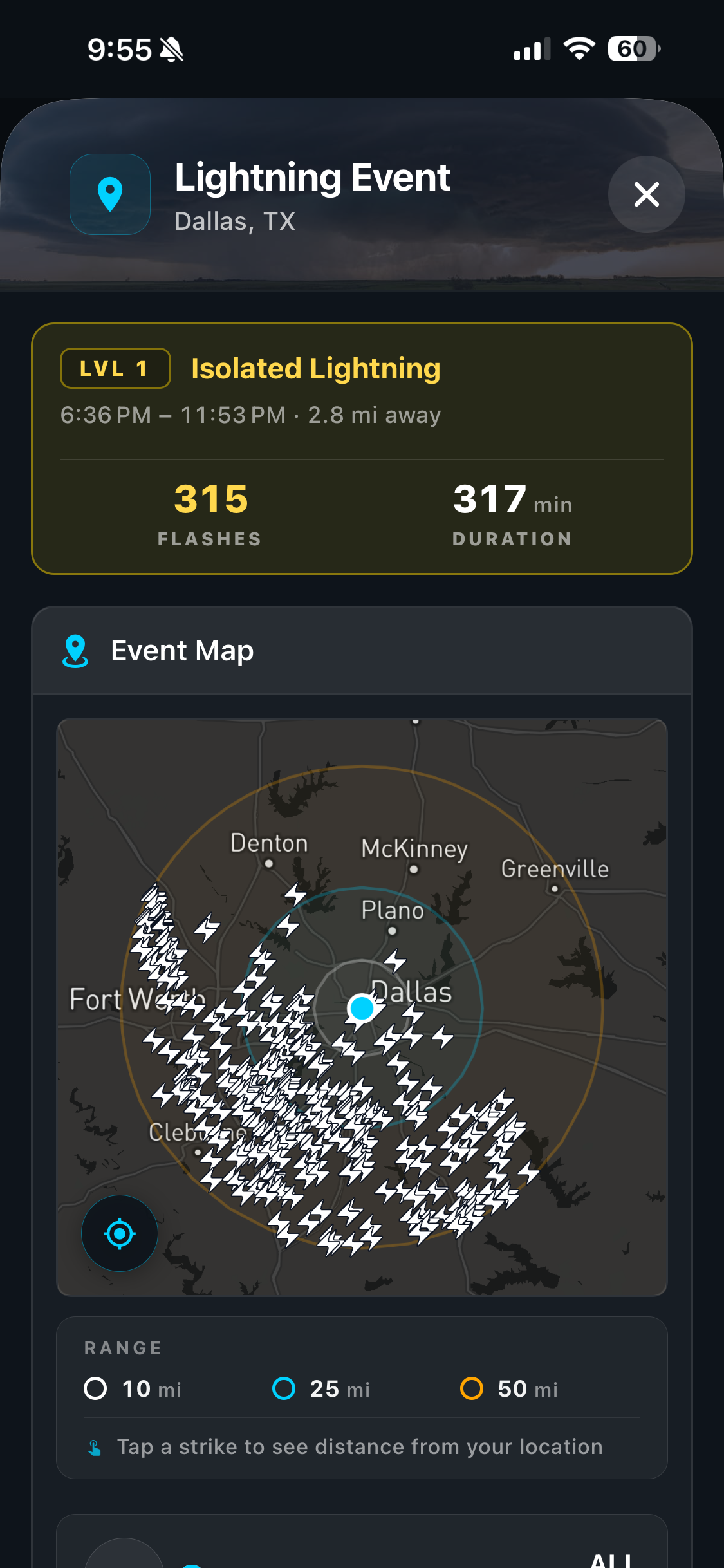
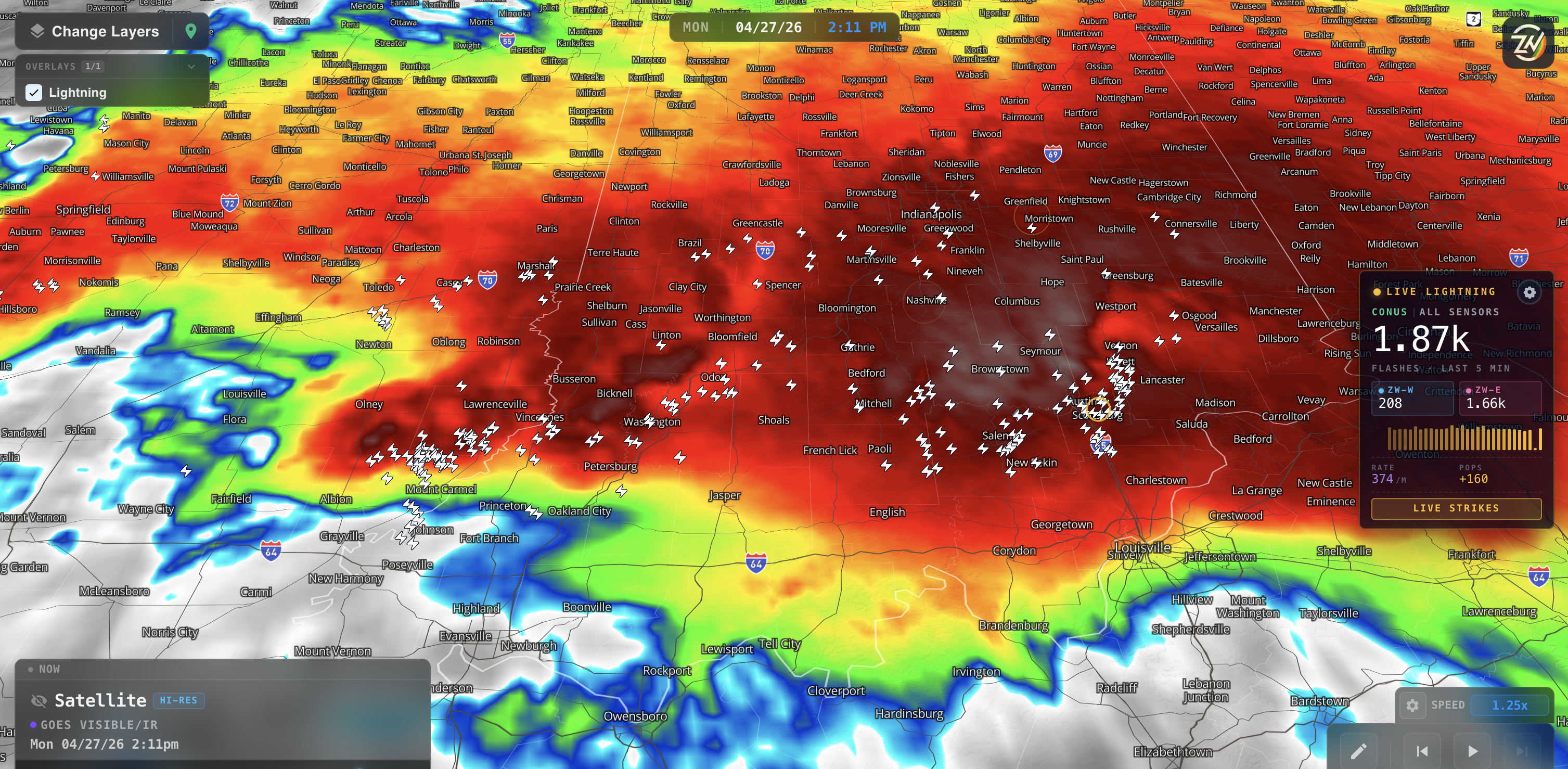
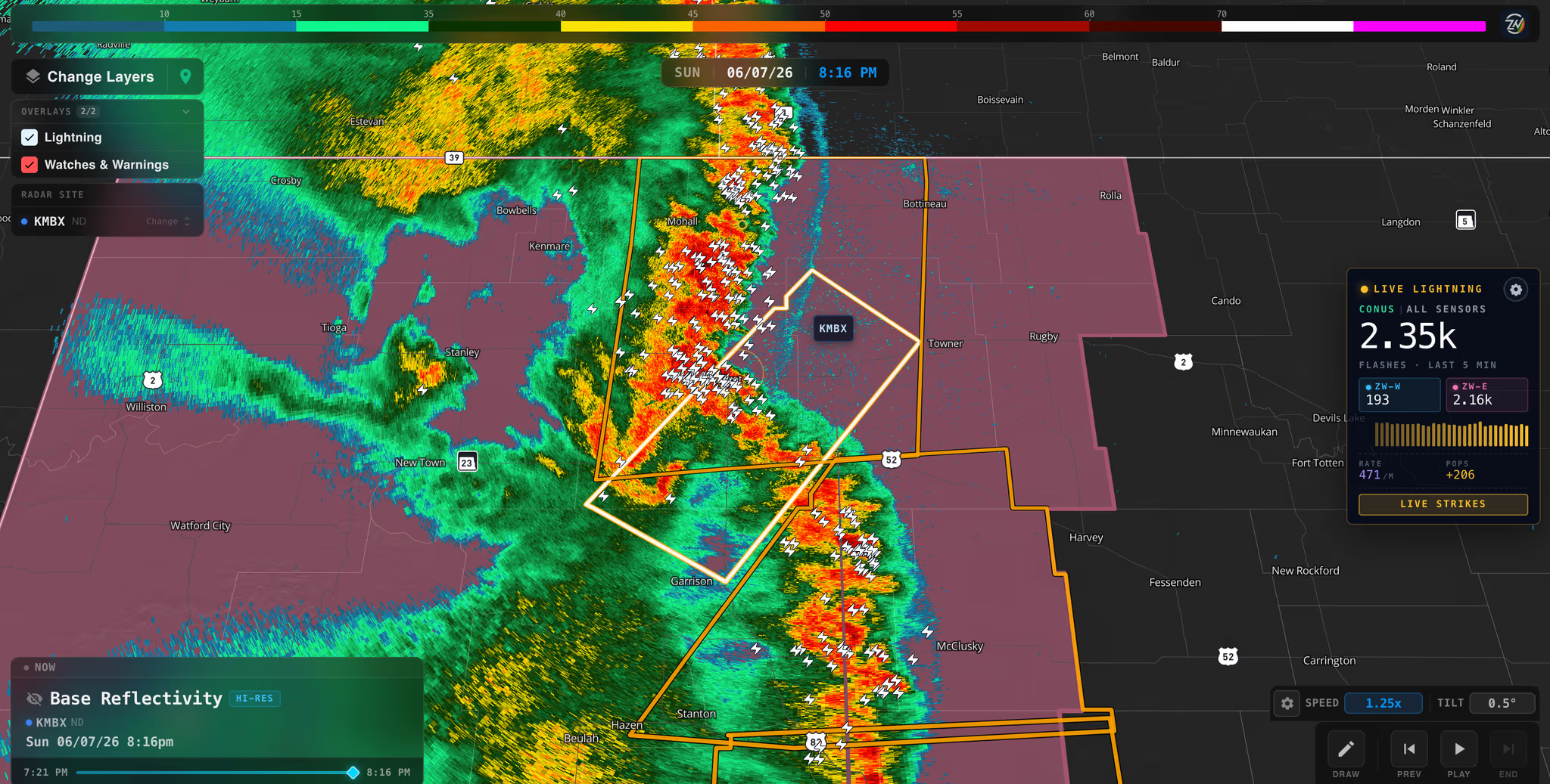
Lightning
Personal strike radius
Second-by-second lightning detection mapped to your personal strike radius
Proximity
Strike zone clarity
Instant clarity on whether you are in the clear or inside the active strike zone
Precision
Strike timing & distance
Strike timing, distance, and approach direction without waiting on generic county alerts
Safety
Real shelter guidance
Shelter guidance tied to real proximity, not broad polygon warnings
All clear
Lightning all-clear
All-clear updates when lightning threat has moved beyond your safety buffer
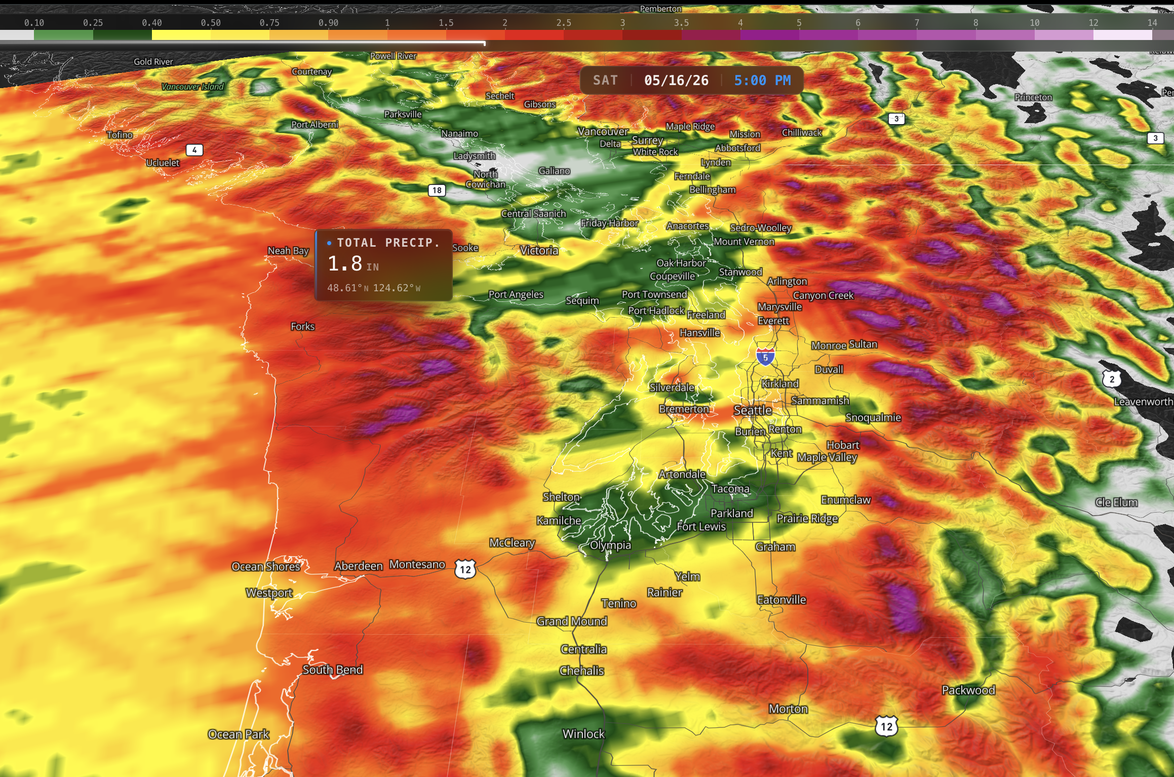
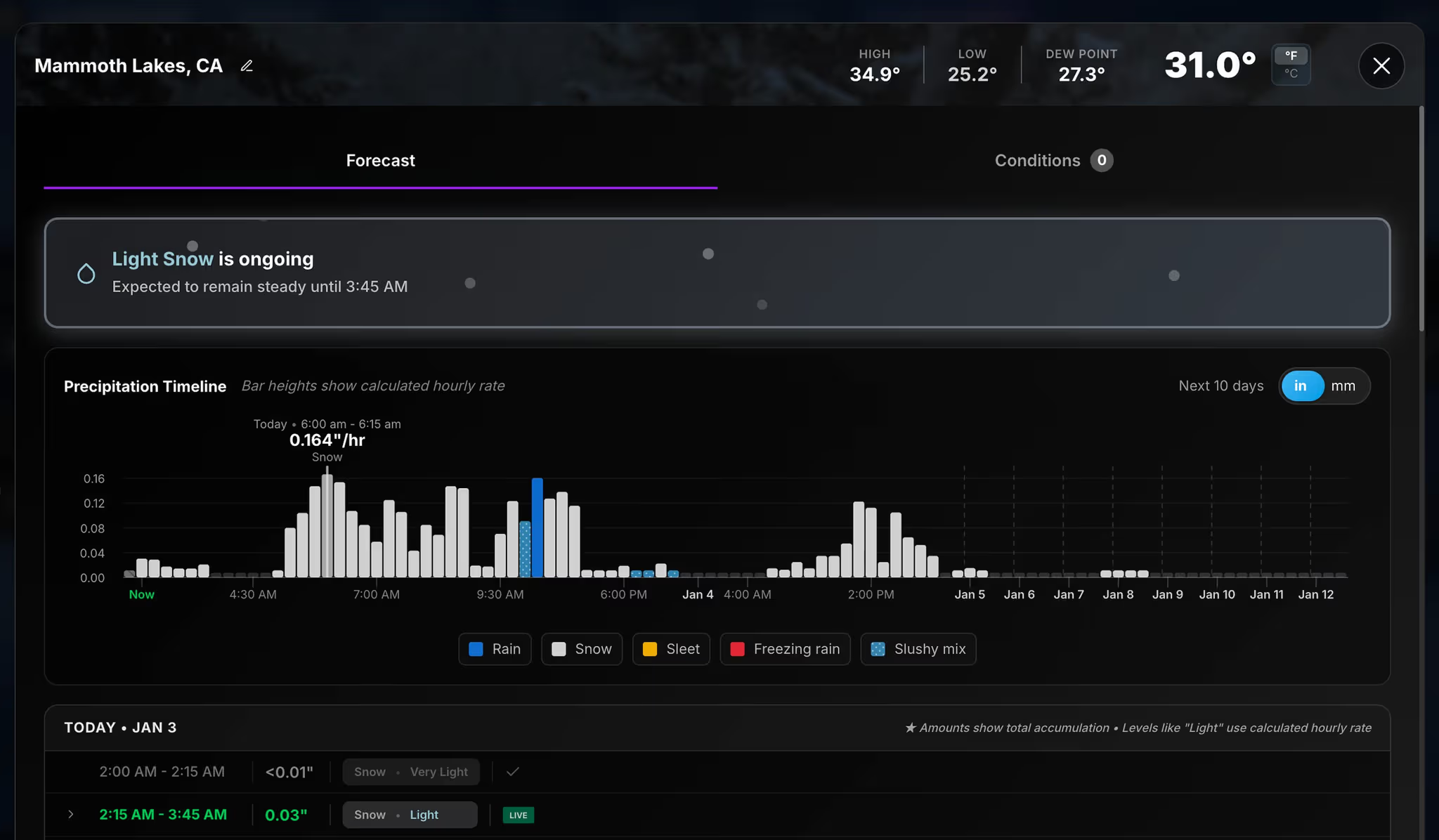
Model suite
3D model mapping
3D mapping of hundreds of models to track rainfall, snow, sleet, ice, and thunderstorm ingredients
Desktop suite
Severe weather signals
Severe weather signals, wind fields, and atmospheric setup visualized in one desktop suite
High resolution
Short-range guidance
Compare short-range and high-resolution guidance before storms ever reach your region
Compare
Model agreement
See how model suites agree or diverge on timing, intensity, and storm mode
Power users
Forecaster depth
Built for forecasters and power users who need depth beyond a single radar loop
Satellite
3D GOES-19 imagery
High-resolution 3D GOES-19 satellite imagery with continuous storm-top perspective
Lightning
Lightning overlay
Second-by-second lightning strikes overlaid on satellite for true situational awareness
Updrafts
Storm evolution
Watch updrafts, outflow, and storm evolution before radar even captures the threat
Systems
Tropical & severe tracking
Ideal for tracking tropical systems, severe clusters, and rapidly developing convection
24/7 view
Day & night monitoring
Satellite plus lightning in one view for day and night storm monitoring
Radar tilt
3D radar tilt
High-resolution radar with 3D tilt to track ongoing storms in depth, not just at one level
Structure
Storm structure slices
Slice through storm structure to see where the strongest cores and rotation are developing
Tracking
Cell lifecycle
Follow cells from formation through maturity across your region of interest
Workflow
Complete nowcast
Pair radar tilt with lightning and model data for a complete nowcast workflow
Control
Desktop-grade control
Desktop-grade control for users who need to see exactly where storms are heading next
Advance notice
Days-ahead precipitation
Precipitation alerts days ahead from when storms first form on model guidance
Live timing
Minute-by-minute updates
Hour-by-hour and minute-by-minute updates as the threat moves toward your saved region
Push alerts
Automatic phone alerts
Intensity changes, start times, and clearance windows pushed to your phone automatically
AWA bridge
Strategy to perimeter
Bridge AWA strategic briefings with automated perimeter alerts at the moment of impact
Lifecycle
Start, peak & clear
Know when rain begins, when it peaks, and when your location is finally back in the clear
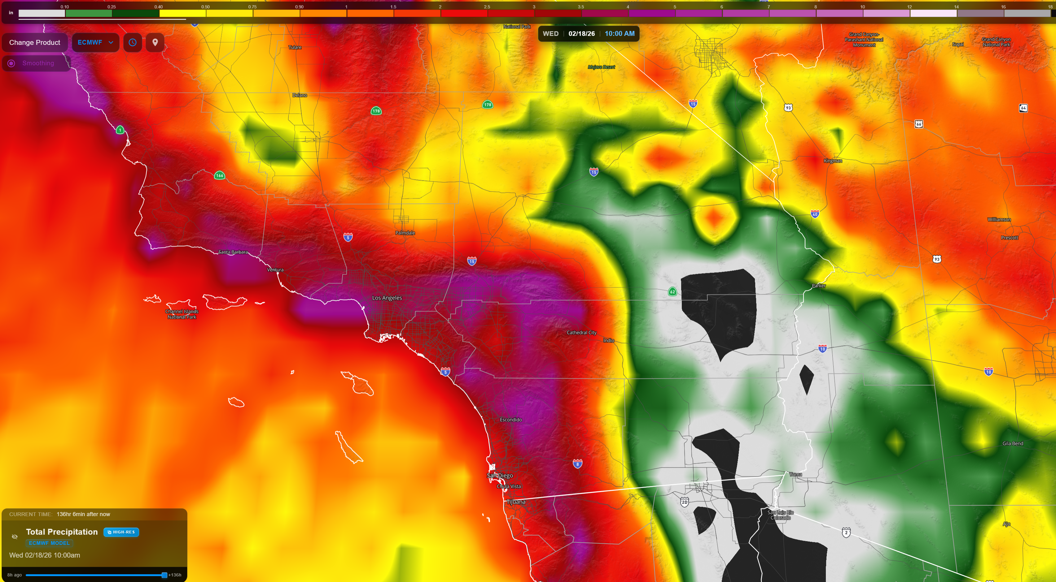
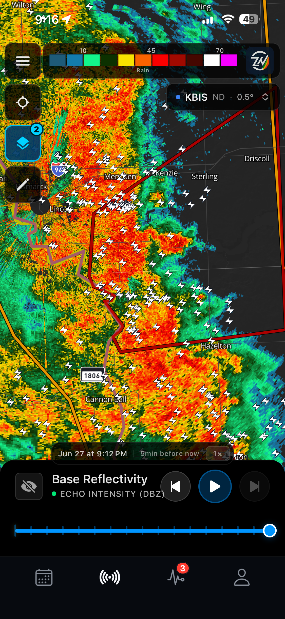
High Resolution Radar
Take control of where the storms are.
ZoneWatch gives you high-resolution models, live radar, lightning proximity alerts, and minute-by-minute updates so you can act early and stay safe.
Instant perimeter alerts for your exact saved locations
Proprietary lightning detection with clear all-clear messaging
Affordable access to pro-grade weather intelligence