
The first storm system in what may become a prolonged active pattern is now arriving across the western United States. This initial round will bring the greatest impacts to Northern California and the Pacific Northwest, where heavier rainfall, gusty winds, dangerous surf and mountain snowfall are expected. By comparison, the Southwest, including Southern California and Arizona, will see a weaker start with lighter and more limited precipitation.
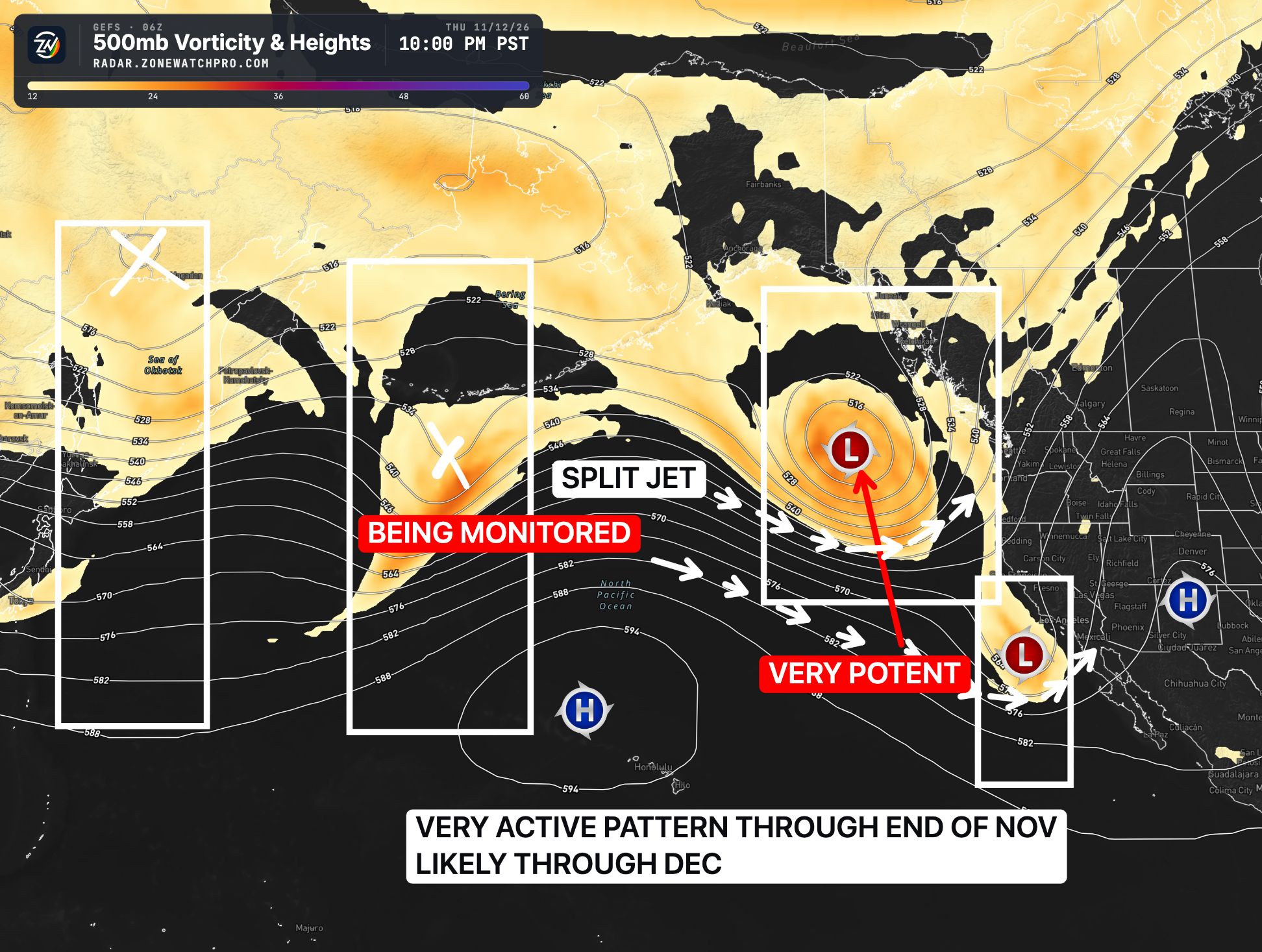
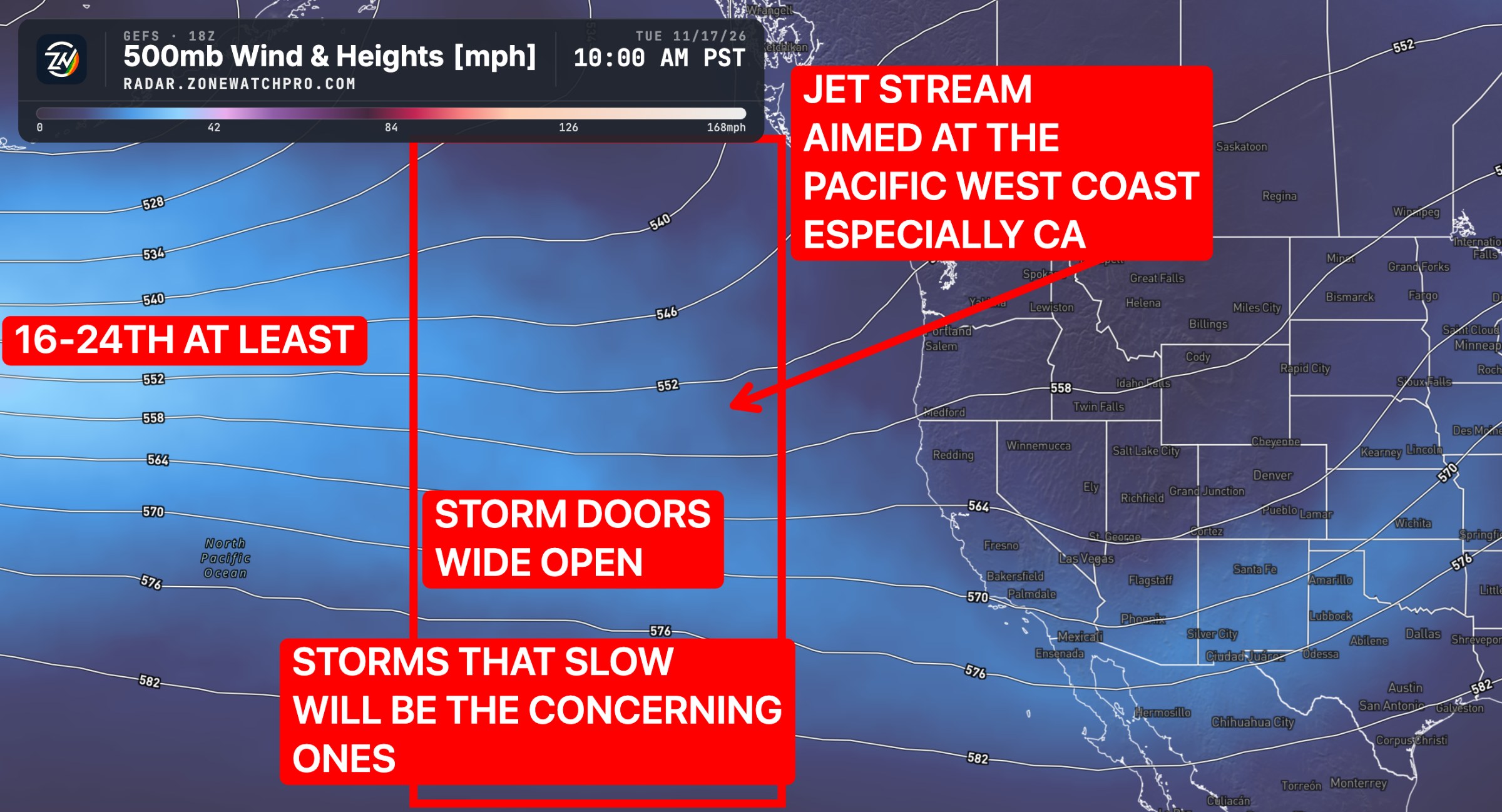
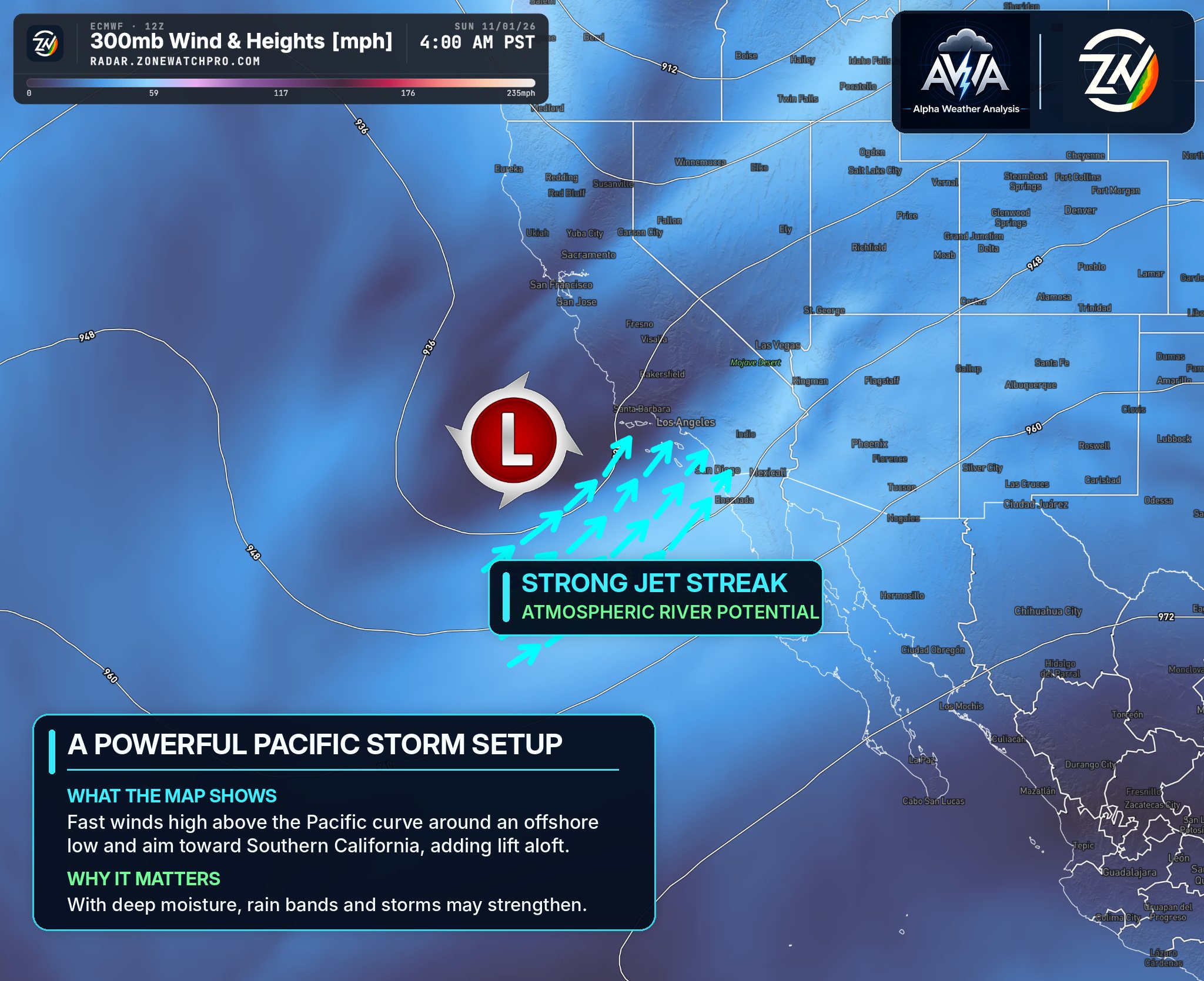
While this first system is important, it also appears to be only the beginning. The broader pattern remains favorable for additional Pacific storms later in November, some of which could become stronger and more impactful depending on storm track, moisture availability and whether atmospheric rivers become involved.
Northern California | November 12–15
Northern California will experience some of the most significant impacts from the first storm, with moderate to heavy rainfall expected Friday into the weekend. Coastal areas and the Bay Area could generally receive 0.50 to 1.75 inches, with locally around 2 inches or greater across favored coastal mountains and Sierra foothills. Interior valleys should receive lighter amounts, generally 0.30 to 0.80 inches.
Strong coastal winds, dangerous surf, localized flooding and accumulating mountain snowfall will be the primary concerns. Higher elevations of the Sierra Nevada could experience difficult travel conditions as snowfall develops Friday into Saturday.
Central California | November 12–15
Central California will experience increasing rainfall Thursday night through Friday, with precipitation favoring coastal communities and surrounding mountains. Regional rainfall totals will generally range from 0.30 to 0.90 inches, with locally 1.50 to 1.75 inches possible along favored coastal slopes. Interior valleys may receive considerably less rainfall.
The primary concerns include locally heavy showers, slick roadways, increased runoff and reduced visibility. Additional precipitation opportunities are expected as the larger storm pattern continues.
Southern California | November 12–15
Southern California will experience a weaker and less organized system compared with areas farther north. Rainfall will develop Thursday night into Friday, with another round possible Friday evening through Saturday morning.
Most coastal and valley communities could receive 0.30 to 0.90 inches, with locally 1.00 to 1.25 inches possible across some foothills and mountain slopes. Rainfall totals will vary, and some inland areas may receive less.
The main concerns include slick roadways, localized water accumulation and isolated heavier showers. A few thunderstorms could develop near coastal areas, although widespread severe weather and significant flooding are not anticipated.
Conditions should improve by Sunday before additional storm systems potentially approach next week.
Arizona | November 13–15
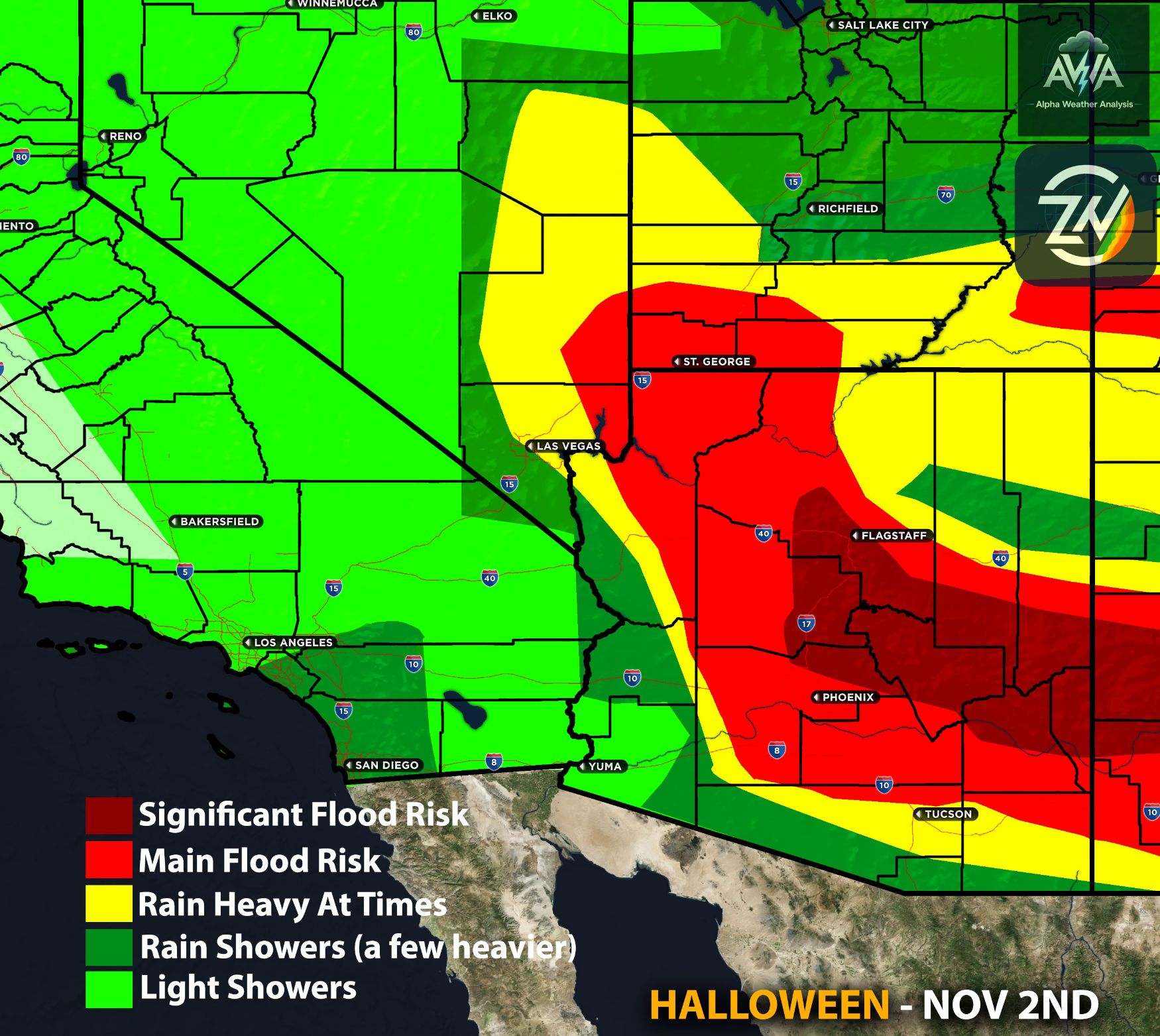
Arizona will experience relatively limited impacts from the initial storm as the strongest atmospheric energy tracks north and south of the state. Most areas could receive a trace to 0.30 inches, with locally around 0.40 inches possible across portions of southern and southeastern Arizona.
Scattered showers and isolated thunderstorms could develop Friday into Saturday, but widespread flooding is not anticipated. The greater concern remains the potential for stronger storms later in November, particularly across locations still recovering from previous significant rainfall.
Nevada, Utah and Colorado | November 13–17
Pacific storm energy will gradually spread inland, bringing gusty winds, periods of valley rainfall and accumulating mountain snow across Nevada and Utah. Higher elevations, particularly near the Sierra Nevada and Wasatch Mountains, could experience deteriorating travel conditions and reduced visibility.
Colorado may experience increasing storm activity early to mid next week as the broader pattern shifts eastward. Mountain snowfall, cooler temperatures and additional precipitation will be monitored for any changes.
Pacific Northwest | November 12–16
Oregon and Washington will remain exposed to repeated Pacific storm systems, bringing periods of moderate to heavy rainfall, gusty coastal winds and dangerous ocean conditions.
Western portions of both states will experience the most consistent precipitation, while higher elevations of the Cascades could see accumulating snowfall as colder air arrives. Localized flooding, hazardous surf and mountain travel disruptions remain the biggest concerns.
Extended Storm Pattern | November 16 Through Late November and Beyond
The first storm is not necessarily the strongest system of the month. The broader atmospheric pattern remains favorable for multiple additional storms moving into California, the Pacific Northwest and portions of the Southwest.
Longer range forecast scenarios suggest cumulative rainfall totals could approach 2.5 to 3 inches across portions of Northern California, 0.75 to 1.75 inches across Central California and 1.5 to 2.5 inches across portions of Southern California. Arizona, Nevada, Utah and Colorado could also experience increasing precipitation totals as additional systems arrive.
These are longer range guidance scenarios, not guaranteed rainfall amounts or totals to add to the first storm. The positioning of the storm track, availability of Pacific moisture and potential development of atmospheric rivers will determine how significant the upcoming systems become.
The possibility of repeated heavy rainfall, increasing flooding risks and additional mountain snowfall will be monitored for any changes.
TL;DR | Summary
The first storm system is arriving across the West, with Northern California and the Pacific Northwest taking the brunt of the initial impacts, including heavier rainfall, gusty winds, dangerous surf and mountain snow. The Southwest will see a weaker first round, with Southern California and Arizona generally receiving lighter precipitation and fewer major impacts.
The bigger concern is that this may only be the beginning. Additional storms later in November could become stronger and bring greater rainfall totals, especially if atmospheric rivers develop. Flooding risks may increase over time as the broader active pattern continues.
Stay tuned for more updates. Should you want more details and specific micro zone breakdown, check AWA services that fit your needs. This also includes risk impact scales.