
A potentially significant and prolonged storm pattern is on going across California and much of the western United States, with multiple Pacific storm systems expected through at least the end of November and potentially into December. Northern California is first in line, followed by Central and Southern California, with additional impacts extending into Arizona, Nevada, Utah, Idaho and Colorado.
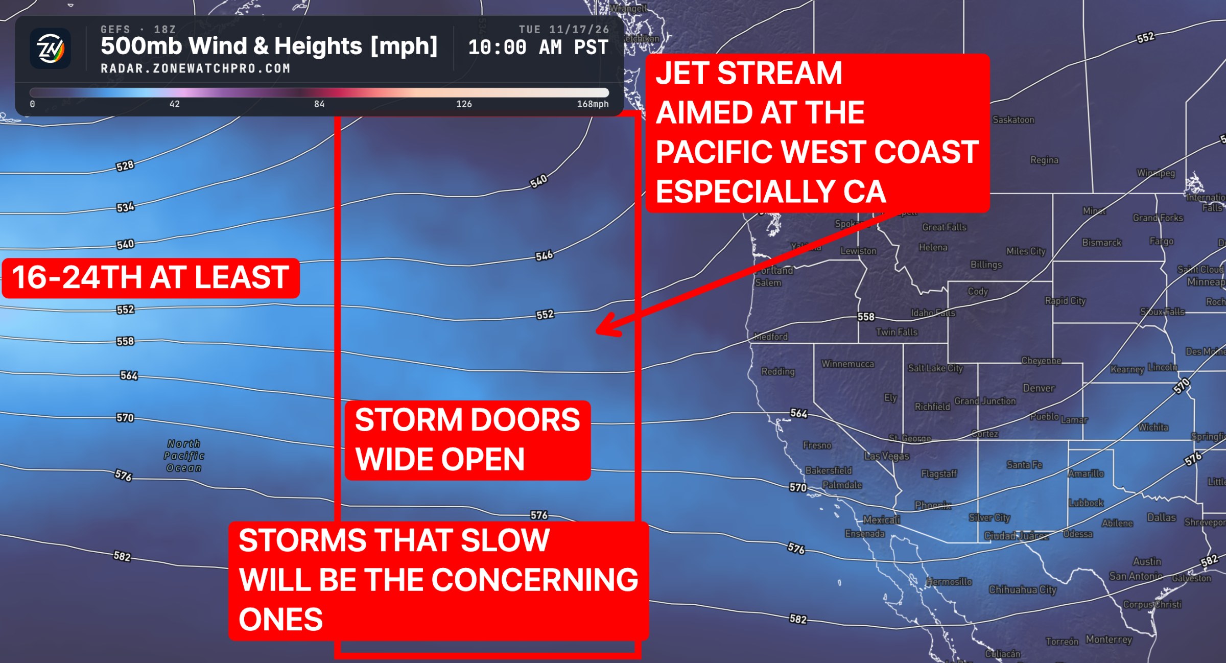
The driving force behind this pattern is a split jet stream that will help direct multiple storm systems toward the Pacific West Coast. Think of it as a powerful water hose shifting north and south, delivering periods of precipitation across different regions.
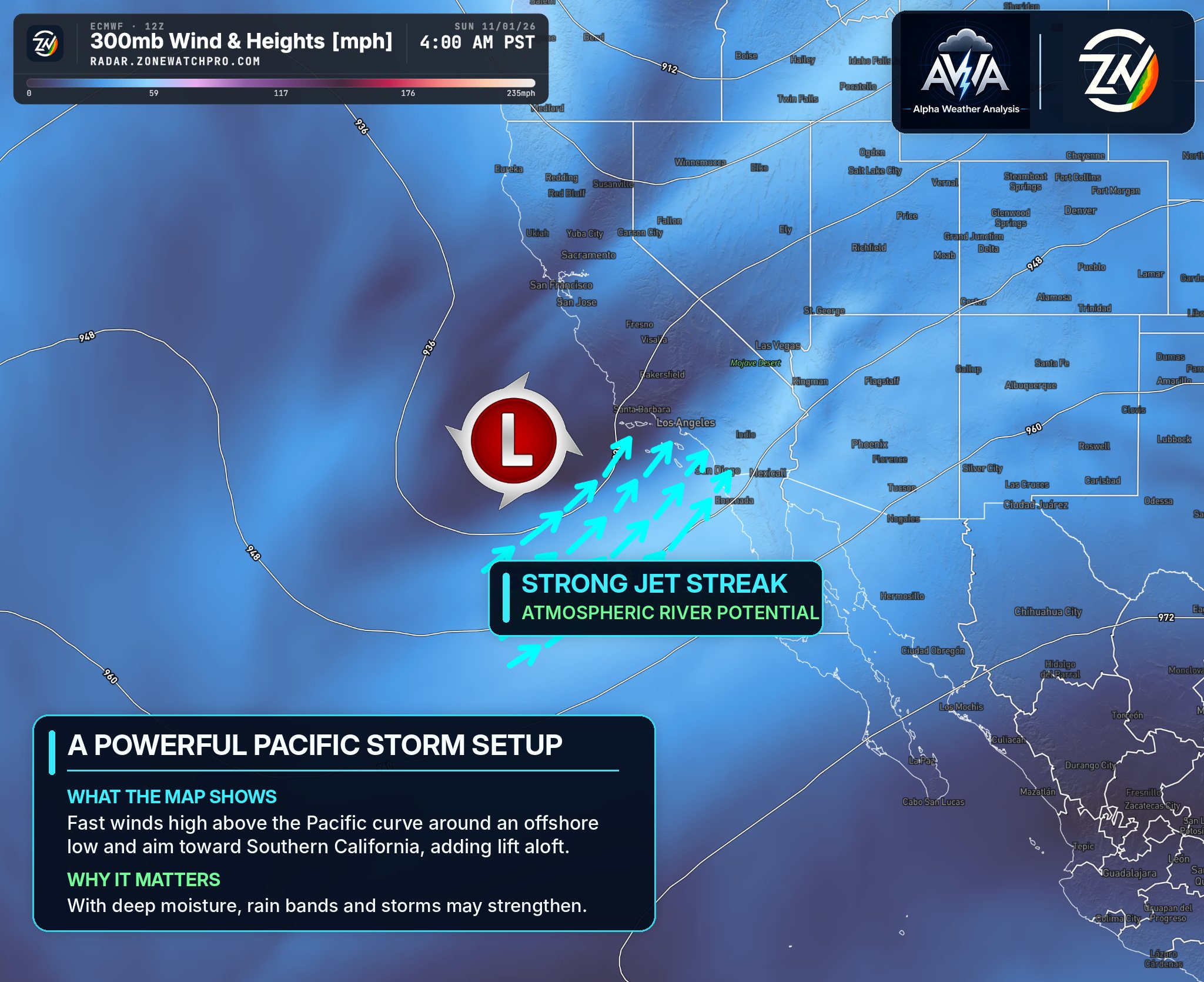
However, not every storm will produce the same impacts. Some systems may remain relatively weak or track inland as inside sliders, while others could deepen, slow down and tap into atmospheric rivers, significantly increasing the potential for heavy rainfall and flooding.
Northern and Central California | November 13–16
Northern California is expected to experience some of the earliest impacts beginning Friday, November 13. Coastal communities from Crescent City and Eureka southward toward the San Francisco Bay Area could see periods of moderate to heavy rainfall, gusty winds and increasing ocean swells. The Sacramento Valley and surrounding foothills could also experience widespread rainfall, with heavier precipitation favoring the coastal mountains and western Sierra Nevada. RAINFALL TOTALS ARE NOT FINAL...
By Saturday and Sunday, the storm pattern is expected to expand farther south into Central California, including Monterey, San Luis Obispo, Fresno and surrounding communities. Higher elevations of the Sierra Nevada could experience accumulating snowfall, although snow levels may initially remain elevated before gradually lowering.
The biggest concerns include localized flooding, strong winds, mountain travel disruptions and the potential for heavier precipitation if an atmospheric river becomes involved. Isolated thunderstorms producing brief downpours, small hail and lightning are also possible as colder air moves into the region.
Southern California | November 13–17
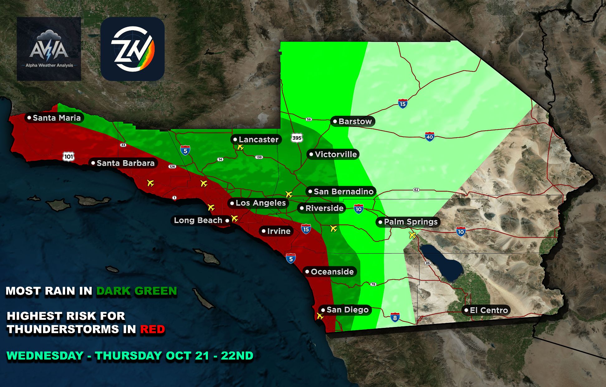
Southern California could begin transitioning toward cooler, cloudier and increasingly unsettled conditions Friday evening, with rainfall opportunities expanding through the weekend and potentially into Monday. Los Angeles, Ventura, Orange County, the Inland Empire, San Diego and surrounding mountains could experience periods of rain, locally heavier showers and gusty winds.
Additional disturbances rotating around the broader offshore circulation could prolong unsettled conditions. Isolated thunderstorms may develop if sufficient instability becomes available, while localized flooding could become a concern where repeated heavier showers occur.
The exact storm track will determine whether Southern California experiences scattered showers or a more organized period of significant rainfall. This will be monitored for any changes, particularly as additional systems approach later in November.
Arizona | November 13–17
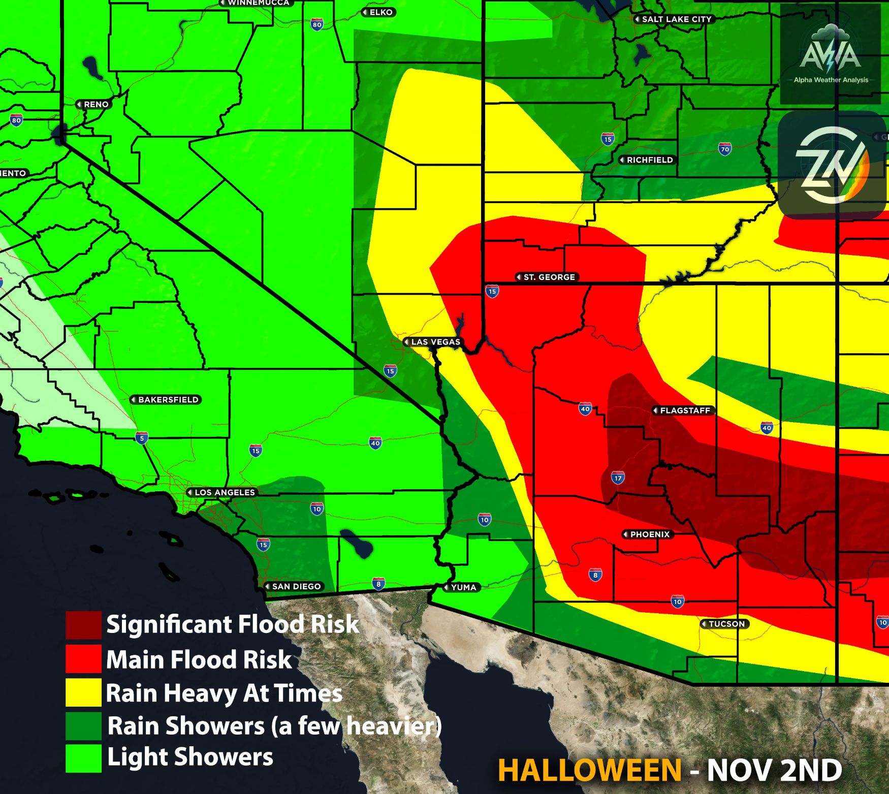
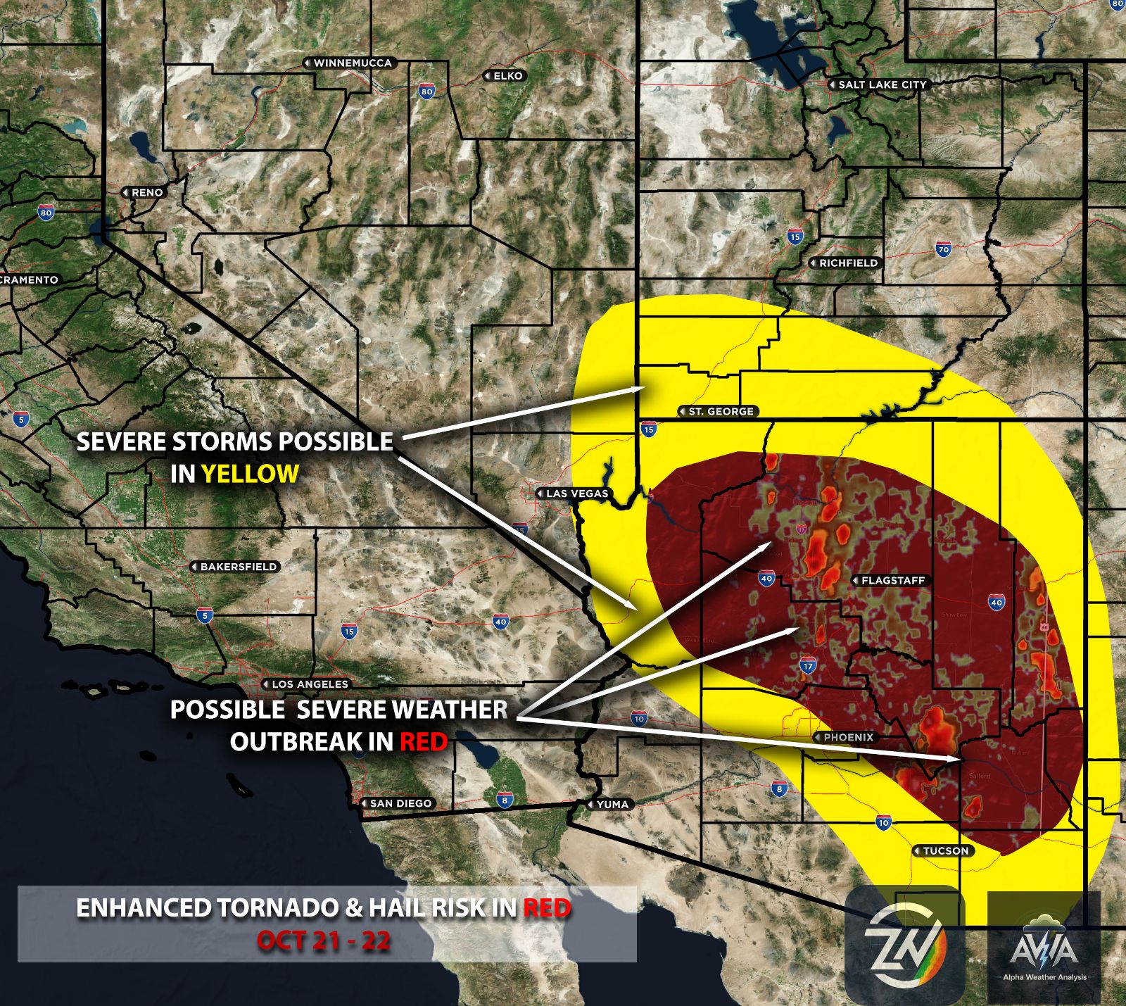
Arizona could experience another round of unsettled weather as a smaller upper level disturbance potentially separates from the larger Pacific circulation and moves toward Baja California and northern Mexico. This could support scattered showers and isolated thunderstorms beginning late Friday or Saturday, particularly across southern and southeastern Arizona.
Northern Arizona, including Flagstaff, Prescott and the Mogollon Rim, could experience cooler temperatures, showers and additional precipitation early next week. Central Arizona, including Phoenix and surrounding areas, may also see increasing rainfall opportunities depending on the northern reach of the disturbance.
Flooding remains an important concern across Arizona, especially in communities still recovering from previous significant rainfall. Saturated ground and vulnerable drainage areas could increase runoff impacts even where additional rainfall totals are relatively modest.
Nevada, Utah, Idaho and Colorado | November 13–17
As Pacific storm energy pushes farther inland, Nevada, Utah and Idaho could experience increasing periods of rainfall, gusty winds and higher elevation snowfall. Northern and western Nevada may see impacts first, while Utah's Wasatch Mountains and Idaho's higher terrain could experience accumulating snow and deteriorating travel conditions.
Colorado may experience a later transition, with the more substantial precipitation opportunities potentially developing around the middle of next week. Western Colorado and the Rocky Mountains could see cooler temperatures, mountain snow and gusty winds, while the extent of rainfall farther east remains being monitored.
The biggest concerns across the interior West include mountain snow, strong winds, reduced visibility and localized flooding in vulnerable areas. The timing, snow levels and strength of each disturbance will be monitored for any changes.
The Bigger Picture | Late November and Beyond
This is not expected to be a single storm event, but rather a prolonged period of repeated Pacific storm activity. The developing pattern could support five or more storm systems through the end of November, ranging from weaker disturbances to potentially powerful systems capable of producing significant regional impacts. Yes, this is all significantly driven by El Niño but also normal for this time of the year… What isn’t normal is the potency & impact potentials.
One of the most important factors being monitored is whether the larger offshore circulation remains in place long enough for additional disturbances to rotate around it and move inland. The possibility of atmospheric river connections, slower moving systems and a southward shifting storm track could substantially influence precipitation totals and flooding potential.
This active pattern may continue into December, although the strength, timing and exact track of individual systems remain subject to change. Upcoming AWA updates will provide more detailed flood risk maps, regional impact assessments and zone specific breakdowns as forecast confidence increases.
TL;DR | What You Need to Know
A potentially significant and prolonged storm pattern is taking shape across California and the western United States, beginning around November 13 and continuing through at least late November, with activity potentially extending into December. Northern California is expected to experience the earliest impacts, followed by Central and Southern California, while Arizona and surrounding western states could also see periods of rain, thunderstorms, gusty winds and mountain snow.
The biggest concern is the possibility of multiple stronger, slower moving systems tapping into atmospheric rivers, increasing the potential for significant rainfall and flooding. Not every system will be equally strong, and the exact impacts will depend on storm tracks and available moisture. Additional details and regional risk assessments will be monitored for any changes but ONLY released via AWA services (Insider, Essential etc DETAILS BELOW on how to join).