
Overall Discussion:
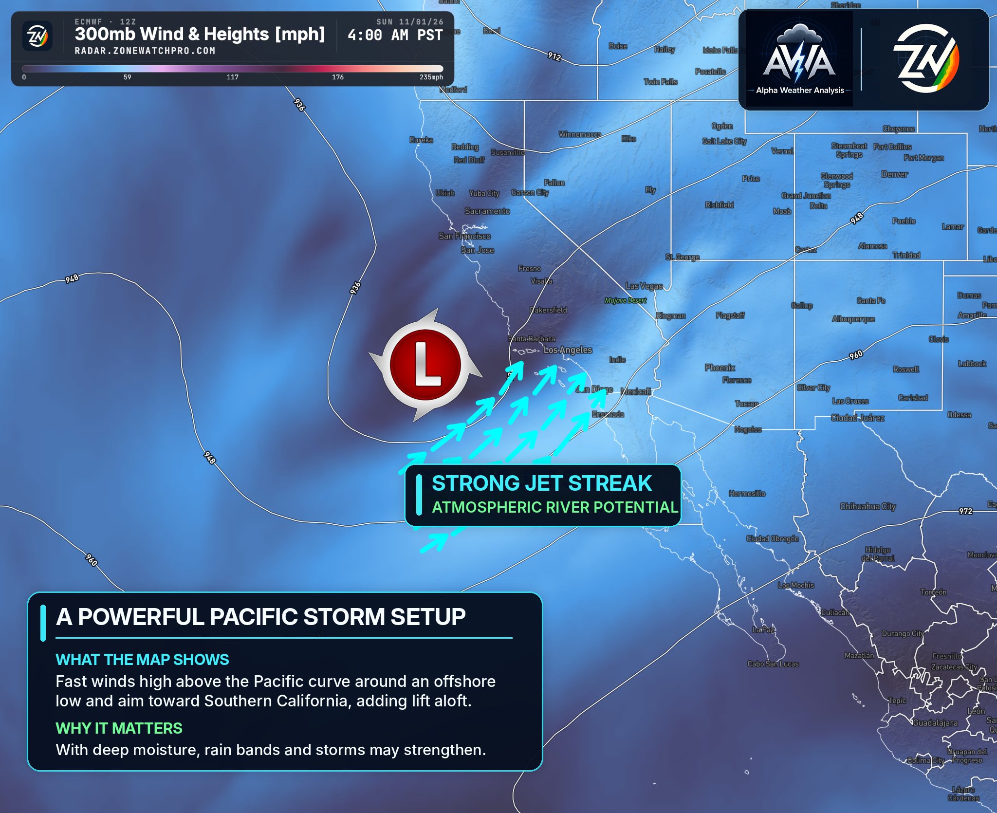
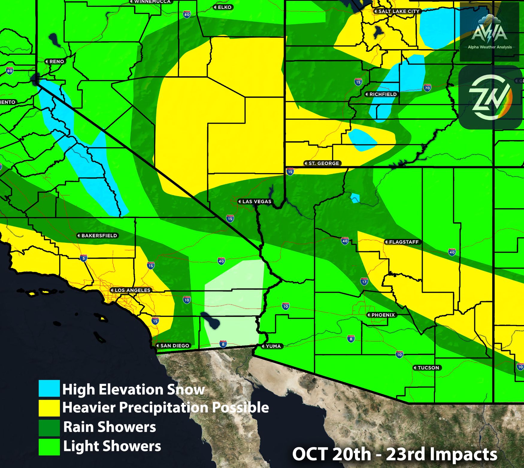
A powerful Pacific storm system interacting with deep subtropical moisture will bring another round of widespread precipitation across the Southwest beginning Saturday night, October 31 (Happy Halloween), and continuing through Monday, November 2. While several states will experience periods of rainfall, the greatest concern remains Arizona, particularly central and northern portions where saturated ground and additional heavy precipitation will significantly increase the threat of flooding.
Southern California will experience a considerably different setup, with primarily light to moderate showers and limited thunderstorm potential, while Utah and southwestern Colorado face heavier precipitation and increasing mountain impacts. One of the most important factors with this system will be the potential for persistent rain bands to produce localized rainfall amounts considerably higher than surrounding areas, particularly across Arizona's mountainous terrain.
Arizona Impacts:
Arizona will experience the most significant impacts from this storm system, especially across northern Maricopa County, Yavapai County, Gila County, Flagstaff and the Mogollon Rim. Rainfall amounts across central and northern Arizona could generally range from 1.75 to 4 inches, with portions of the eastern Mogollon Rim and surrounding higher terrain potentially receiving 3.5 to 6 inches or more where persistent rain bands develop.
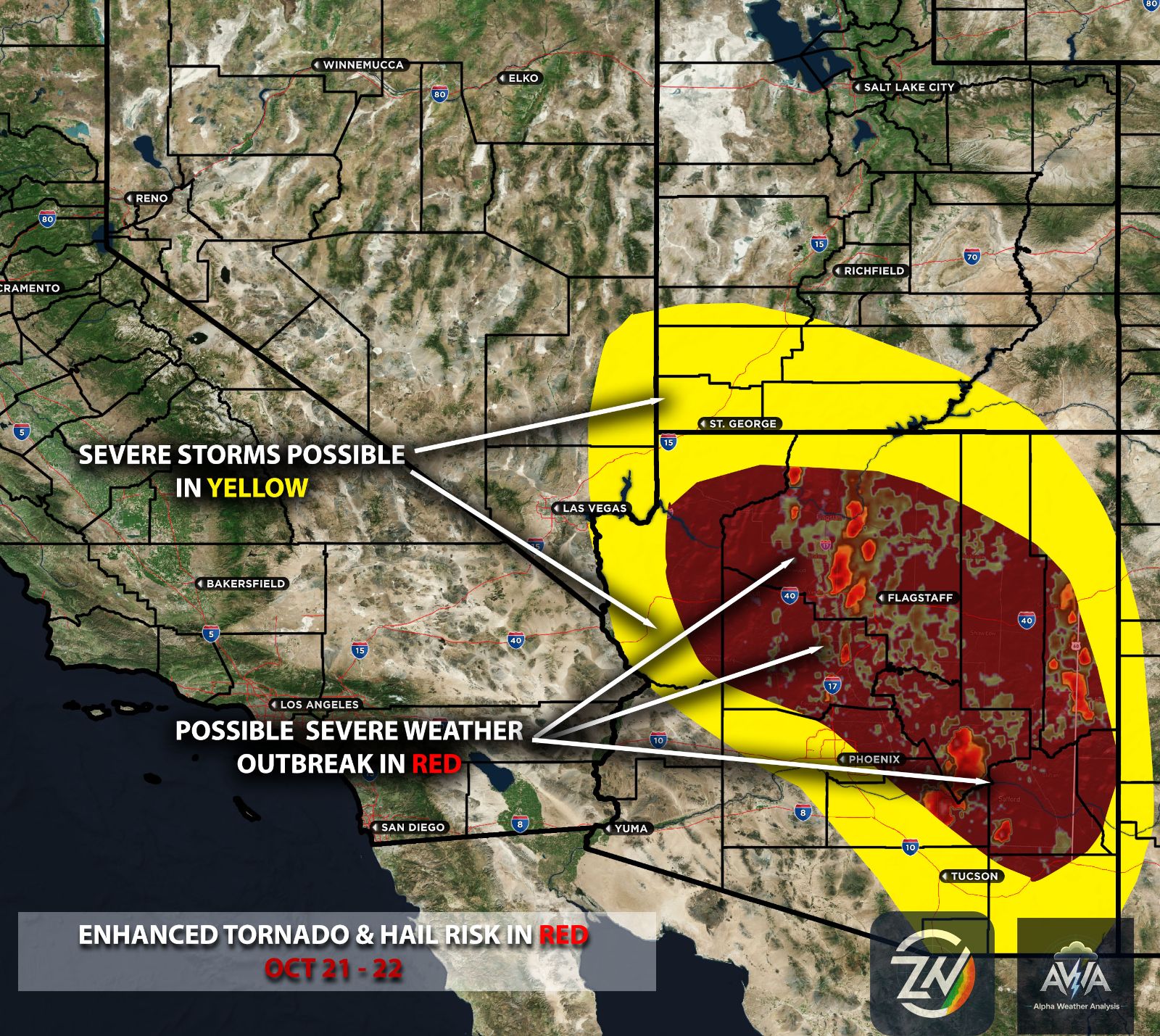
Across the Phoenix metropolitan area and surrounding foothills, approximately 1.5 to 3.5 inches will be possible, while southern and southeastern Arizona could receive approximately 0.50 to 1.75 inches, with localized higher amounts in thunderstorms. The greatest concern will be significant flash flooding, rapidly rising washes, overflowing creeks and rivers, and dangerous runoff over already saturated ground, with embedded thunderstorms potentially increasing rainfall intensity Sunday.
Some precipitation guidance may be underestimating localized accumulations, particularly from northern Maricopa County eastward toward the Mogollon Rim, making this corridor especially important to monitor. The primary impacts are expected Saturday evening through Sunday night, with lingering flooding and elevated water levels continuing into Monday.
Southern CA Impacts:
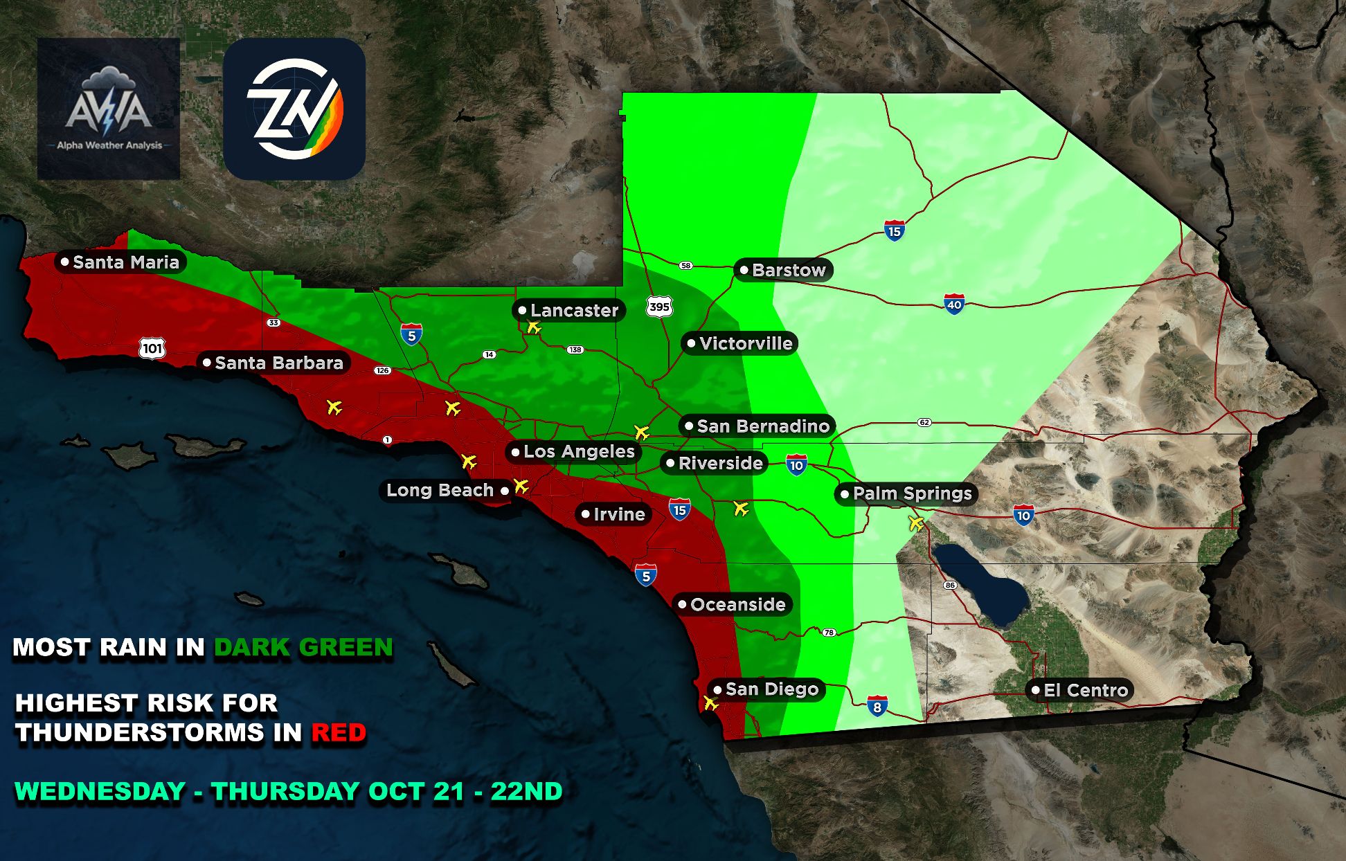
Southern California will experience periods of light to moderate rainfall beginning Saturday evening, with the most widespread showers expected late Saturday night through Sunday morning. San Diego County could receive approximately 0.60 to 1.25 inches, with the highest totals generally favored across inland foothills and mountain communities, while occasional heavier pockets of rainfall may affect coastal and metropolitan areas.
Across Orange County, Los Angeles County, western Riverside County and portions of San Bernardino County, rainfall amounts will generally range from 0.35 to 1 inch, with locally greater amounts possible where repeated showers develop. The overall flooding concern across Southern California remains low, although temporary roadway ponding and minor drainage issues could occur beneath heavier showers.
For San Diego County, we do not see a meaningful thunderstorm risk with this setup, as widespread cloud cover, limited surface heating and weak atmospheric instability will make organized thunderstorm development unfavorable. Most communities should primarily experience periods of steady showers rather than widespread intense thunderstorms, with conditions gradually improving later Sunday.
Central and northern California will experience a less significant precipitation event, with the greatest moisture generally focused farther south and east. Coastal portions of central California, including Santa Barbara and Ventura Counties, could receive approximately 0.25 to 0.70 inches, while the San Joaquin Valley and portions of Northern California will generally experience lighter accumulations ranging from little measurable rainfall to approximately 0.30 inches.
Across Nevada
Nevada will also experience a more variable precipitation pattern Saturday evening through Sunday, with western and southern portions generally receiving approximately 0.15 to 0.60 inches, while eastern Nevada and nearby mountainous terrain could receive approximately 0.75 to 1.50 inches. The greatest concerns across eastern Nevada involve localized heavy rainfall, isolated thunderstorms and rapid runoff, particularly in vulnerable drainage areas and elevated terrain.
Although Nevada's impacts will generally be less widespread than Arizona's, localized flooding remains possible where heavier precipitation develops, especially across eastern portions of the state.
Utah and Southern Colorado
Utah and southwestern Colorado will experience another significant round of precipitation Sunday through Monday as the Pacific storm advances inland and interacts with colder air. Across Utah, precipitation amounts could generally range from 0.75 to 3 inches, with southern and eastern portions facing an elevated flash flooding concern, particularly around washes, slot canyons and areas that have already experienced substantial rainfall.
Southwestern Colorado, including the Four Corners region, the San Juan Mountains and surrounding valleys, could receive approximately 1.25 to 3 inches of precipitation, with locally greater than 3 inches of liquid equivalent possible across favored higher terrain. Persistent rainfall over saturated watersheds will increase the potential for flooding, rising river levels and hazardous travel conditions, while colder air arriving Sunday night into Monday will allow precipitation to transition into accumulating snow across higher mountain elevations.
AWA Overall Assessment: Overall, our greatest concern remains Arizona, where prolonged rainfall over saturated ground could produce significant flooding even without widespread severe thunderstorms, while southern Utah and southwestern Colorado face additional flooding and mountain impacts. These rainfall ranges represent approximate storm guidance rather than exact totals through Monday, and the placement of heavier rain bands will continue to be monitored for any changes.
Stay tuned for more updates…Keep in mind should you need more timing or very specific exact location risk maps/assessment check out AWA services specializing for that.