A powerful, late-summer heat dome is setting up across the western United States, bringing a prolonged stretch of intense temperatures and dangerously dry conditions from Wednesday, August 19 through Friday, August 21, 2026 & beyond. If you thought you were finally done sweating through your shirts for the summer, the atmosphere has a searing plot twist in store for you.
An analysis of the mid and upper levels of the atmosphere products indicates a massive upper-level high expanding over the Great Basin. Height values are modeled to peak at extreme, highly anomalous levels, which which we can confirm is essentially the meteorological equivalent of turning the sky into a giant, invisible convection oven.
Utah: From Baking to Steam Cooker
From Wednesday afternoon through Thursday evening, Utah will sit directly under a strengthening high-pressure system, creating an extreme heat risk for anyone spending time outdoors. According to the mid & upper level guidance, this massive ridge will initially bake the state with unbroken sunshine and highly anomalous temperatures.
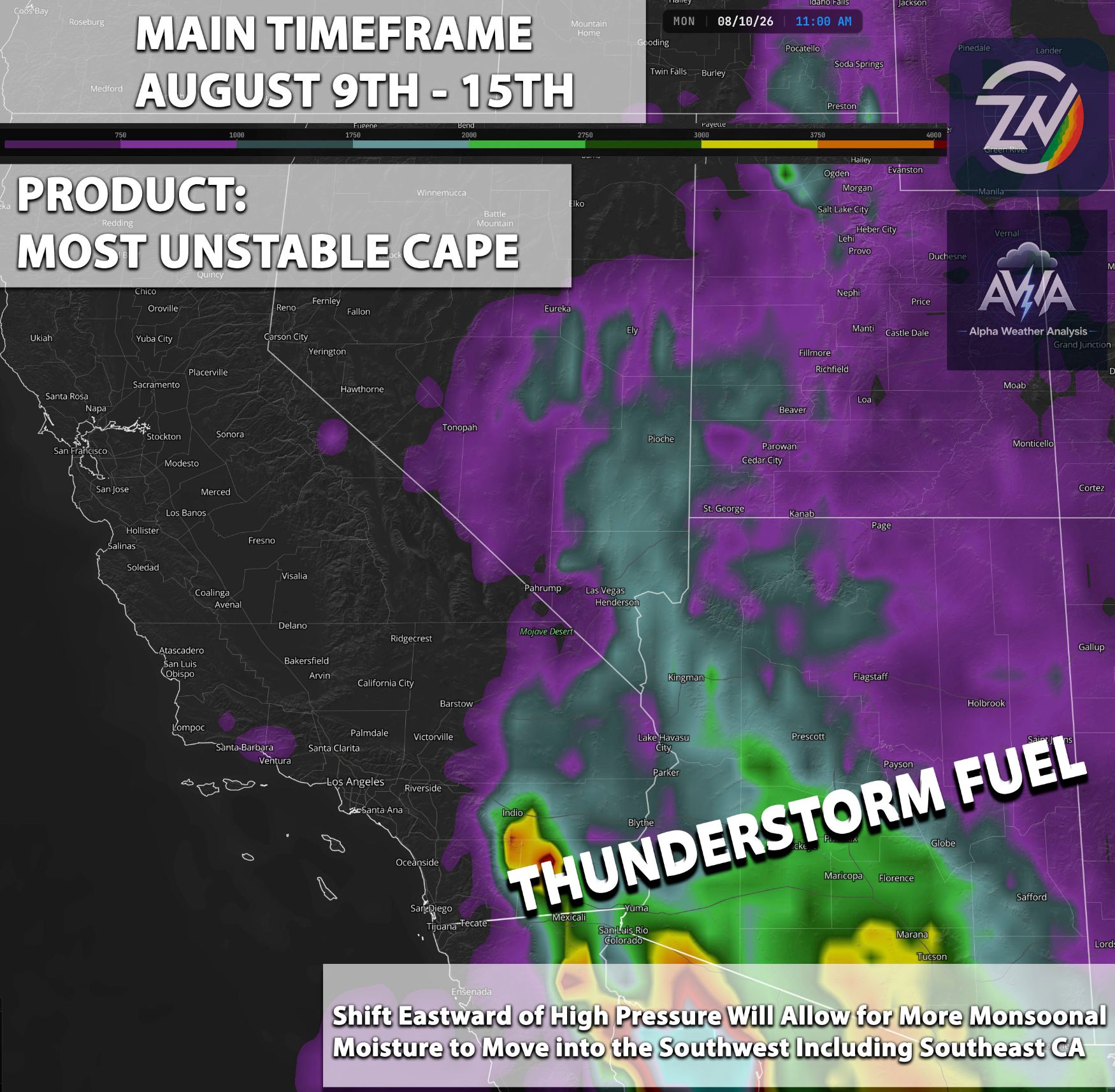
However, regional forecasting experts note that this high will shift eastward toward the Four Corners by Friday morning. This subtle atmospheric move opens the door for deep monsoonal moisture to surge northward into the state, completely changing the weather narrative.
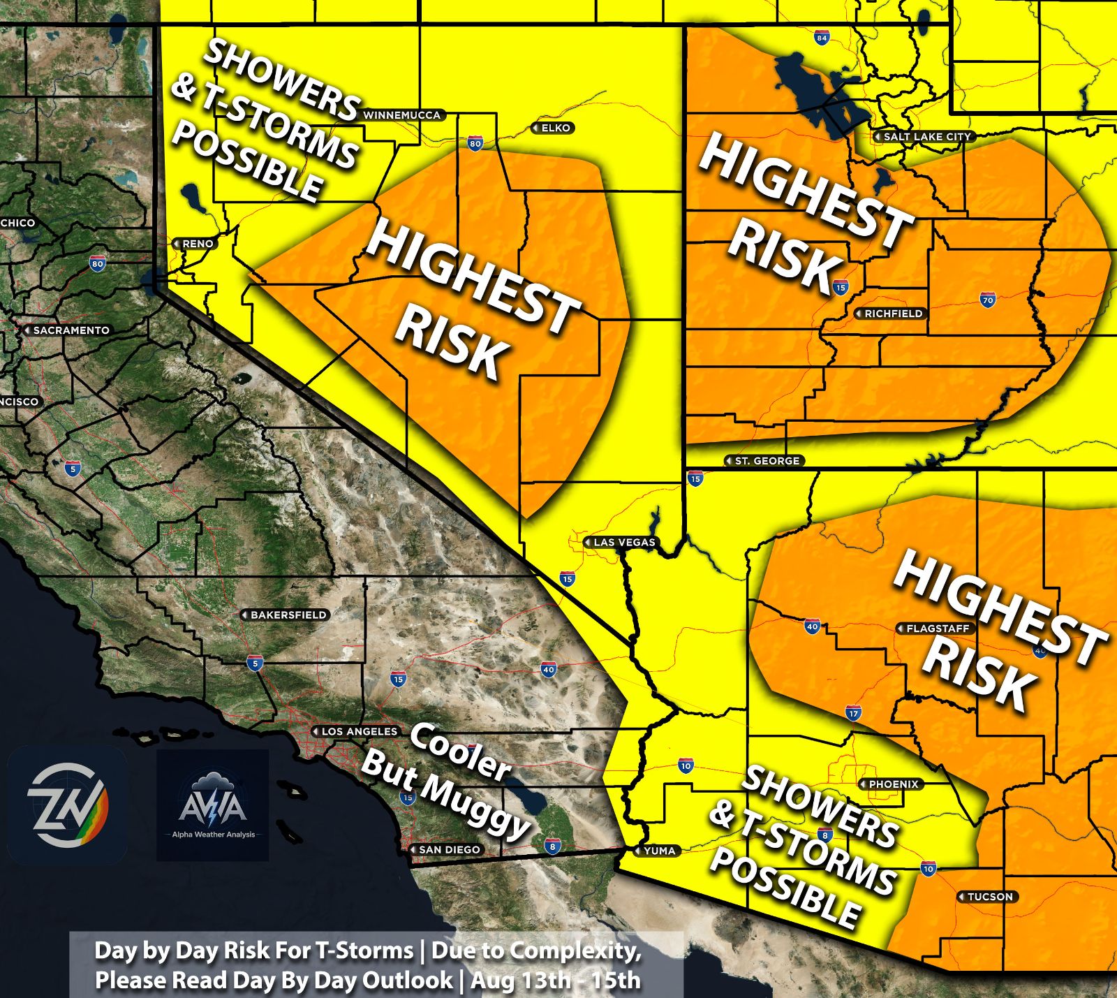
The precipitation water & mid level humidity shows this incoming moisture, which will significantly increase the risk for thunderstorms as we close out the workweek. By Friday afternoon, locals will need to trade their sunshades for umbrellas, as an elevated flash flood risk officially takes over the forecast.
Nevada & Las Vegas: Swapping Sunscreen for Hot & Sticky
From Wednesday morning straight through Wednesday night, a shortwave trough will move out, allowing high pressure to strengthen directly overhead before shifting eastward by Friday. Area forecasters note this ridge axis will eventually linger over the Four Corners, which is a highly favorable setup for a major weather pattern change across Nevada.
This specific atmospheric shift opens the door for monsoonal moisture to be advected northward into the state. The ECMWF Precipitable Water guidance reflects this transition, bringing an increased risk for thunderstorms and an elevated flash flood risk beginning Thursday and extending through Friday.
Higher terrain regions might see this thunderstorm risk develop even sooner, forcing locals to keep a close eye on the sky. By Friday, regional experts stress that this moisture surge will keep an active flash flood risk firmly in place to wrap up the workweek.
Arizona: Midweek Monsoon Surge Before Friday Sizzle Steam Steam Cooker
While low-grade monsoon conditions kick off the start of the week with only isolated storms, moisture gets drawn rapidly back into the state by midweek. From Wednesday afternoon through Thursday night, the ECMWF Precipitable Water guidance shows deep moisture surging northward, increasing thunderstorm coverage and an elevated flash flood risk across northern and eastern high terrain.
As we head into Friday morning through Friday evening, strong atmospheric sinking and incoming dry air will gradually push the moisture axis eastward. Local forecast discussions confirm this shift will noticeably decrease thunderstorm risk across western and central valleys, allowing an extreme heat risk to settle back across the desert floor.
High & Low Deserts: Zero Shade Permitted & Just Bake
From Wednesday morning all the way through Friday evening, regions like the Coachella Valley and Death Valley will be trapped directly beneath a deeply sinking, bone-dry air column. The Precipitable Water models & mid level products that measure the humidity indicate a very low risk of moisture aloft, meaning you will not even get a sympathetic cloud to briefly block the scorching sun during peak daylight hours.
Area forecast discussions warn that unimpeded solar radiation will drive an extreme heat risk from late morning through each afternoon, pushing daily temperatures toward historic territory for late August. If you have ambitious outdoor plans in the desert during the midday hours this week, regional experts highly recommend that you kindly reschedule them for November.
Southern California & Inland Empire: Rising Humidity, Capped Storms Followed By Monsoon
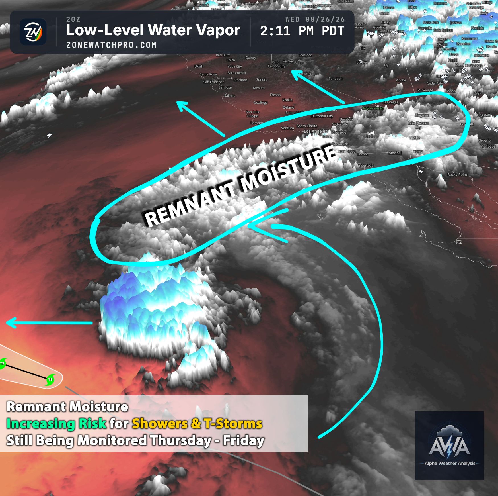
From Wednesday afternoon through Thursday morning, strong high pressure parked overhead will bring unseasonably hot conditions and a major heat risk across the Inland Empire. However, area forecast discussions note that as the high centers closer to the Four Corners region late in the week, south-to-southeasterly flow aloft will steer another round of monsoonal moisture into the region.
According to Precipitable Water & 500-700mb Humidity models, moisture begins to steadily increase from Thursday afternoon through Friday evening. Even with the extra moisture elevating mugginess and warm nighttime temperatures, the persistent ridge overhead will keep instability lacking, significantly capping any widespread thunderstorm risk through the end of the workweek. There will be times when the cap will not break and hold causing storms to fail to initiate.
Northern California: Elevated Fire Danger & Stable Air Mass
From Wednesday afternoon through Friday evening, Northern California will sit on the western flank of the ridge with persistent, above-average inland heat. Official regional outlooks confirm that atmospheric moisture is practically nonexistent across the interior, leading to a major heat risk for the Sacramento Valley and surrounding foothills during peak daytime hours.
The ECMWF 700mb Height and Relative Humidity products highlight critically dry air aloft mixing down to the surface (sinking air) each afternoon through Friday. Area forecasters agree that when combined with breezy offshore winds, this dynamic creates an elevated fire weather risk and rapid fuel-drying conditions through the end of the workweek.
Stay tuned for more updates and daily updates as each day the complexity requires more day to day updates.