Overall Summary of the Pattern:
The weather models are painting a picture of a robust moisture influenced pattern setting up shop across the Southwest. Basically, prepare for nature to turn on the giant swamp cooler. The expectation is that there will be some selective regions who get more of her attention.
The Atmospheric Setup:
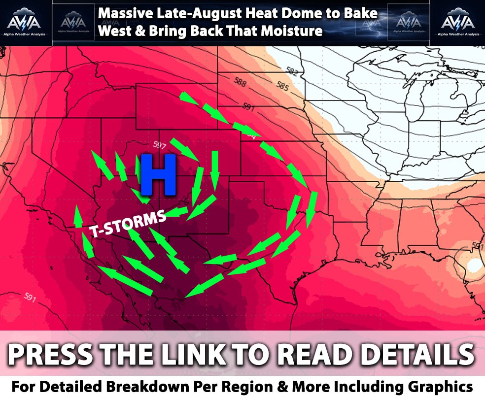
As shown in the upper level steering maps and high pressure strength forecasts, a massive upper level ridge parked over the Southern Plains is stretching its legs westward throughout the period. At the same time, a Pacific trough cruising to the northwest (you can easily spot it showing off in the upper level wind speed maps) helps keep a deep, stubborn southerly to southwesterly steering flow going strong.
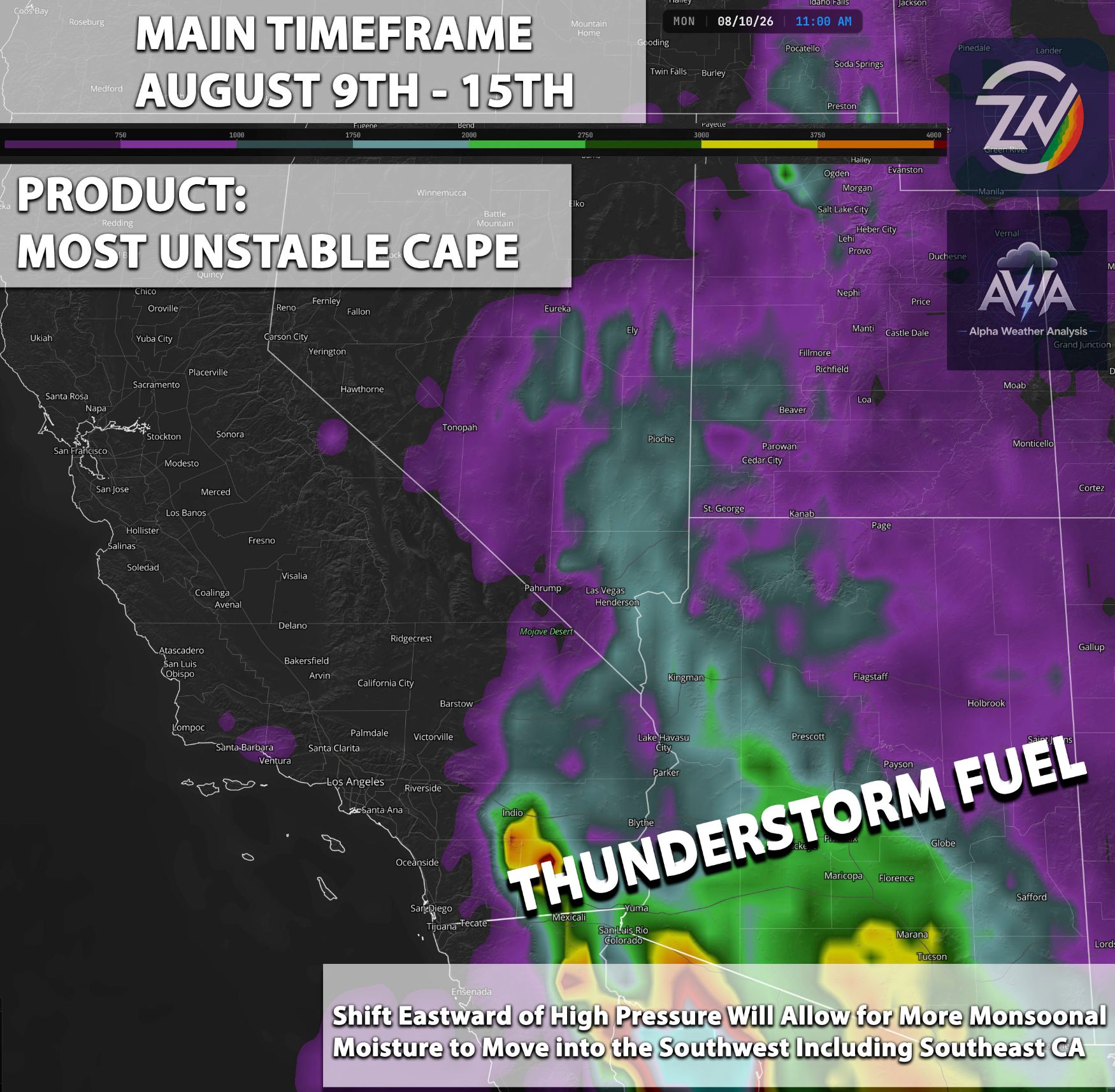
The moisture pump think of this interaction as a giant atmospheric water pump. It is aggressively funneling a rich, decidedly soggy plume of subtropical moisture straight from Mexico and the Gulf of California right into the Desert Southwest and Great Basin. Mid level moisture is highly prominent, meaning the air up there is essentially turning into soup.
Looking Ahead By August 15th, the high pressure cranks up even more according to the high pressure strength forecasts. This flex in pressure drives precipitable water values ridiculously higher than average across the Interior West, just as the total atmospheric moisture maps proudly display.
Let us break down this wonderfully humid situation piece by piece.
Arizona:
In Arizona, the state is positioned squarely within the core axis of the monsoonal moisture transport, turning the region into a giant atmospheric sauna. This results in extremely rich thermodynamic profiles with widespread high moisture levels as indicated by the total atmospheric moisture maps and a completely saturated mid level atmosphere.
This setup drives a highly active period with widespread, robust daily thunderstorms. The primary operational threats will be heavy rainfall, flash flooding especially in elevated terrain and those pesky burn scars, and strong outflow boundaries sweeping across the lower deserts like a dusty leaf blower someone forgot to turn off.
Southern California:
For the coastal and valley regions of Southern California, conditions will remain on the drier, western fringe of the deep moisture plume, thankfully keeping the bulk of the significant monsoonal moisture trapped east of the mountains where it belongs. Consequently, the weather will generally be just plain hot and aggressively muggy.
While convection will largely stay anchored to the inland terrain, mid to high level moisture will occasionally drift westward, allowing anvil blow off to shade the valleys and act as natures very weak attempt at air conditioning to suppress daytime high temperatures slightly. Portions of Southeast CA do have a risk for those monsoonal storms especially on August 15th (wait for the update for details).
Inland Empire & CA Deserts:
The Inland Empire and Californias high and low deserts will experience direct, cyclical incursions of the moisture plume wrapping around the western periphery of the high pressure system. This leads to a pronounced moisture surge into the Coachella, Imperial, and Mojave deserts where total atmospheric moisture climbs significantly by August 14th and 15th.
This incredibly soupy environment creates a high probability of intense, terrain driven diurnal thunderstorms, bringing elevated risks of severe microbursts, blowing dust, and rapid onset flash flooding that will turn normally dry washes and lake beds into very sudden, highly uninvited water features.
Nevada (Including Las Vegas):
Nevada, including the Las Vegas valley, sits directly in the crosshairs of the northward surging moisture channel positioned between the offshore trough and the eastern ridge. This allows deep moisture to penetrate completely through the southern and central parts of the state as clearly indicated by the absurdly saturated values in the mid level humidity maps.
This setup fosters an active and potentially volatile convective period characterized by daily scattered to numerous thunderstorms. Mother Nature is basically rolling the dice here, bringing erratic outflow winds that will ruin your hair, abrupt temperature drops, and localized flash flooding just to keep the casinos on their toes. Why not? It’s the vibe there anyway.
Utah:
In Utah, the deep, uninhibited southerly flow acts as a giant atmospheric fire hose to pump subtropical moisture straight northward into the state. This spreads anomalously high total moisture and mid level humidity values steadily from south to north through the period. These highly favorable dynamics will support widespread, terrain induced thunderstorms, particularly along the central and southern mountain ranges.
Heavy downpours and flash flooding will be the primary hazards, making this a spectacularly terrible weekend to practice your photography skills inside any slot canyons or low lying recreational areas.
Northern California:
Northern California remains blissfully shielded from the deep monsoon moisture and is instead heavily influenced by the Pacific trough clipping the Pacific Northwest. This maintains a dramatically drier atmospheric profile with minimal to zero mid level moisture compared to the absolute swamp sitting to the south and east.
As a result, conditions will be generally dry with breezier winds driven by increased onshore flow, keeping the region free from intense heat and convective threats. They get to comfortably watch everyone else sweat, though elevated fire weather concerns may certainly arise if these breezy winds decide to align with critically dry fuels.
Stay tuned for more updates.