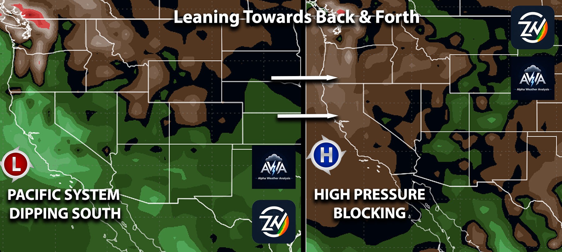
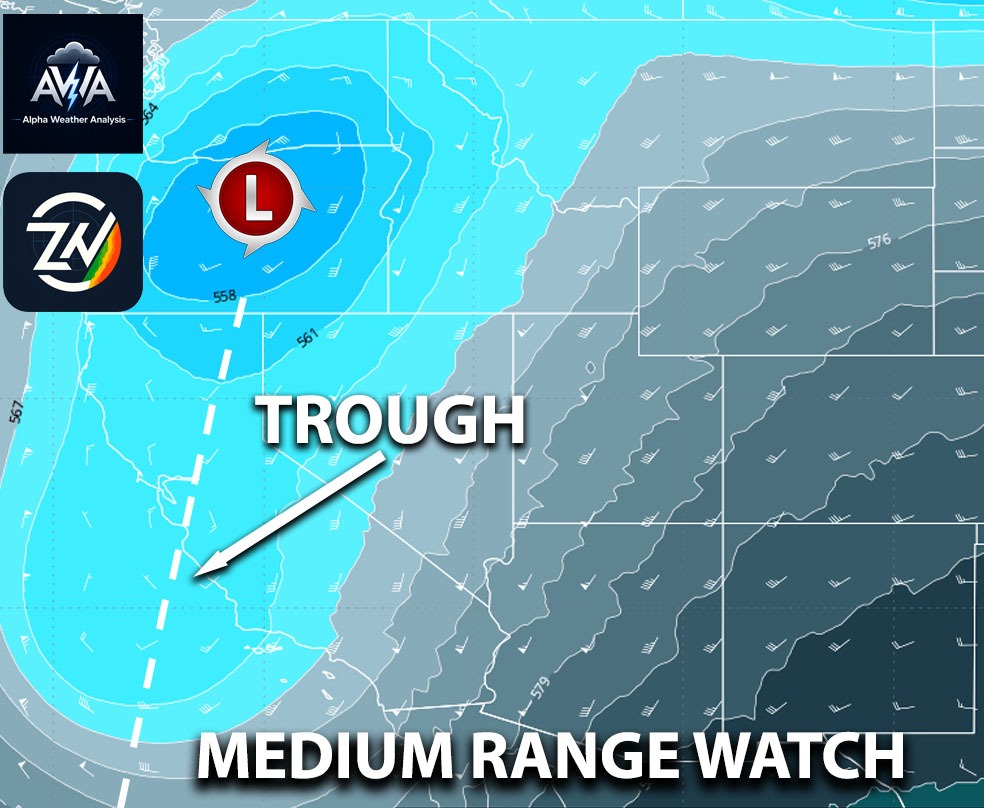
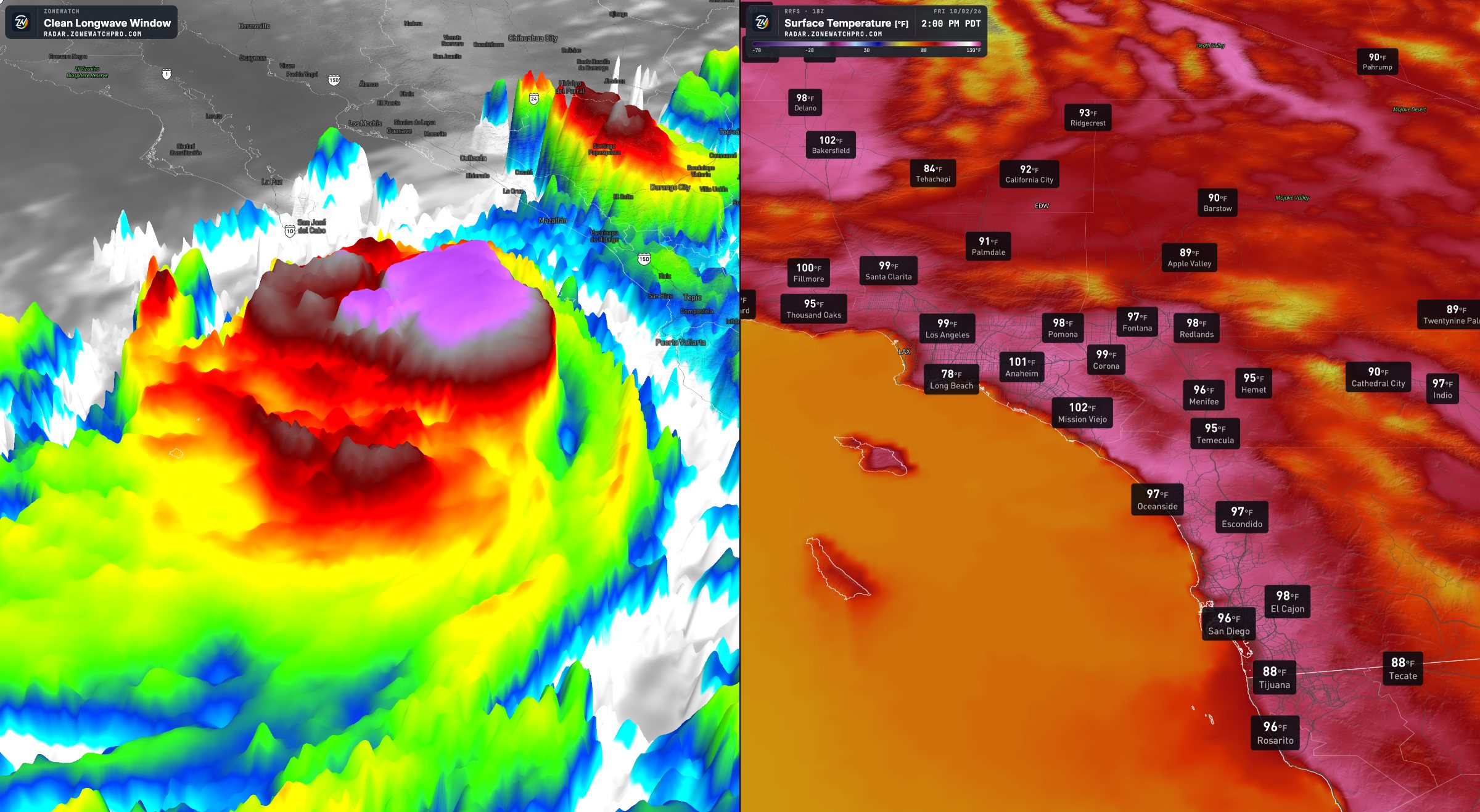
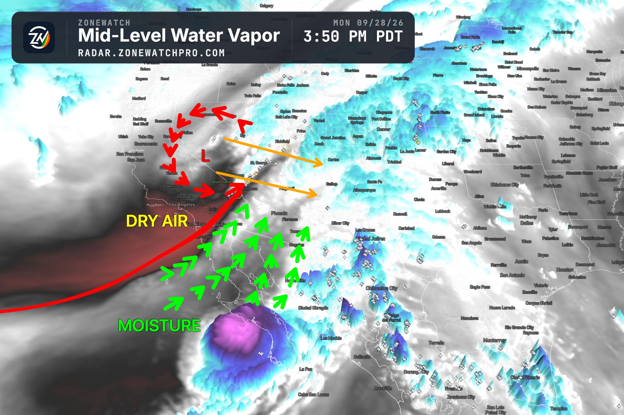
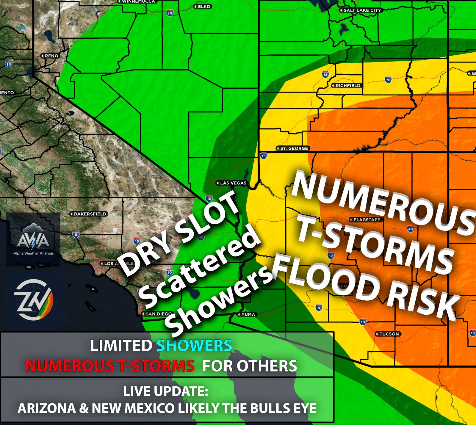
Once again, the setup remains to be very complex, so it is no surprise that the track remains difficult to pin down with now almost two areas of shift possible. A cutoff low, an upper level trough, and what remains of Rachel all have to interact, with their timing and positioning playing a major role in how this unfolds. Even small changes could shift where the deepest moisture moves, where the lifting mechanism is, where thunderstorms develop, and which areas receive the heaviest rainfall. That is why individual model runs can show noticeably different outcomes. Confidence should improve as these features evolve, but the exact track and rainfall totals still have room to change still.
The Setup In Depth:
This complicated setup involves three different weather systems coming together, with the exact location and timing of their interaction determining rainfall amounts, lightning activity, and the potential for severe weather and damaging winds. The biggest influence will likely be the large upper level polar disturbance swinging southward before ejecting eastward as these systems interact.
Even a small change in the strength, speed, or track of that disturbance could shift where the deepest moisture and strongest lift overlap. That overlap will be critical in determining which areas receive the heaviest rainfall and strongest thunderstorms.
A slower progression could allow heavy rain to persist longer over some locations, while a faster movement could shorten the rainfall duration but still bring a period of intense weather. The details of how these systems come together will make a significant difference in the impacts from one location to another.
What Type of Impacts Are We Expecting?
Going to take the risk just based on overall analysis that this will not be just humidity for southern CA we can put that scenario out the window (if it happens I will question many things). Regardless jokes aside there are two shifts we’re watching carefully given the timing of the polar upper level disturbance timing while the merge occurs.
The scenario goes from San Diego being the bullseye for a tropical storm with some tropical storm conditions possible but mainly remnant moisture to a shift towards the east where the metros still get showers and t-storms but a lot less numerous compared to a direct hit.
Scenario A Direct hit to San Diego, CA (The Center):
Widespread of showers and numerous thunderstorms would bring periods of heavy rain and gusty winds, with a greater concentration of precipitation reaching the San Diego, OC and LA metro area. Impacts would extend across Southern California, although rainfall amounts and storm intensity would vary by location. Repeated rounds of heavy rain could increase the potential for localized flooding, and wherever thunderstorms repeatedly move over the same locations.
Scenario B East Shift Towards Eastern Southern CA (The Center):
This scenario appears more consistent with the current projected track, with tropical storm conditions still possible across Southern California, especially in Imperial County, including the Imperial Valley, and areas farther east.
Impacts would still reach Southern California’s metro areas, with showers and embedded thunderstorms likely and a few cells potentially producing heavy rainfall. Gusty winds would be a concern in both scenarios across Southern California, especially from eastern portions of the region into western Arizona. In this scenario, Los Angeles would see fewer impacts, with impacts generally decreasing farther northwest, away from the system.
For Arizona, this track would increase the potential for very heavy rainfall and damaging winds, especially across western and northern portions of the state. Much of Arizona would still receive at least some showers, although precipitation totals would vary.
Las Vegas and areas farther northeast would also face potential flooding concerns, especially as the trough pulls the moisture north and northeast.
Our Analysis on The Track History & Potential Impacts:
The track looks likely to fall somewhere between Scenarios A and B, favoring widespread showers across Southern California, with a thunderstorm risk extending throughout the region. Thunderstorm chances would be higher across the mountains and other elevated terrain, as well as along convergence zones where winds come together and enhance lift. Coastal and metro communities would still have a risk, although storm coverage and intensity would vary by location.
Areas where the deepest moisture overlaps with the strongest lift could experience periods of heavy rainfall, frequent lightning, and locally damaging wind gusts. Repeated thunderstorms over the same locations could also increase the potential for localized flooding.
As the system ejects eastward, the threat would shift into Arizona and surrounding regions, bringing the potential for additional heavy rainfall and thunderstorms. The exact timing and track will determine where the strongest storms develop and how long the heaviest rain persists. This blended scenario would spread potential impacts across a broader area, although not every location would receive the same rainfall or storm intensity (just a reminder).
TLDR Summary: Rachel’s remnants, a cutoff low, and an upper level trough are expected to interact, bringing Southern California more than just humidity, with widespread showers, thunderstorms, gusty winds, and localized flooding possible. A track between a more direct San Diego impact and a shift toward Imperial County and western Arizona appears most likely, with higher thunderstorm chances across mountains and convergence zones, though coastal and metro areas would still face a risk. Heavy rainfall and potentially damaging winds could spread into western Arizona & especially Colorado River Valley, with flooding concerns extending toward Las Vegas as moisture moves northeast. Small changes in timing and track will determine where the strongest impacts occur, so rainfall totals and storm coverage remain uncertain but the track is starting to lock in. Rain expected, T-storms for many, and severe weather for some...
Stay tuned for more updates! Risk assessment models & custom maps will be out shortly adjusting more each day as we approach the event only on AWA Insiders. You can also track Rachel and the whole setup right on the ZoneWatch app or web platform. Check details on ZoneWatch on top.