If you have not already heard, all meteorologist eyes are glued across the tropics watching a very interesting setup. Here is my completely unbiased analysis breaking down the possibilities, ranging from the absolute worst case scenario down to the minimal impact scenario where Mother Nature barely clears her throat.
We do not like rushing out updates declaring worst case doom based on just a couple of long range computer models. Discretion is necessary.
When predicting an event this complex, certain unnamed individuals and dramatic news outlets love hyping up a direct slam with hurricane force impacts into Southern California. The likelihood of that actually happening is substantially low, for reasons I will break down.
Let us get into the details before the hype train derails.First, this disturbance has not even developed yet, though it is expected to organize by tonight or early tomorrow morning. The system should track northwest around 10 mph.
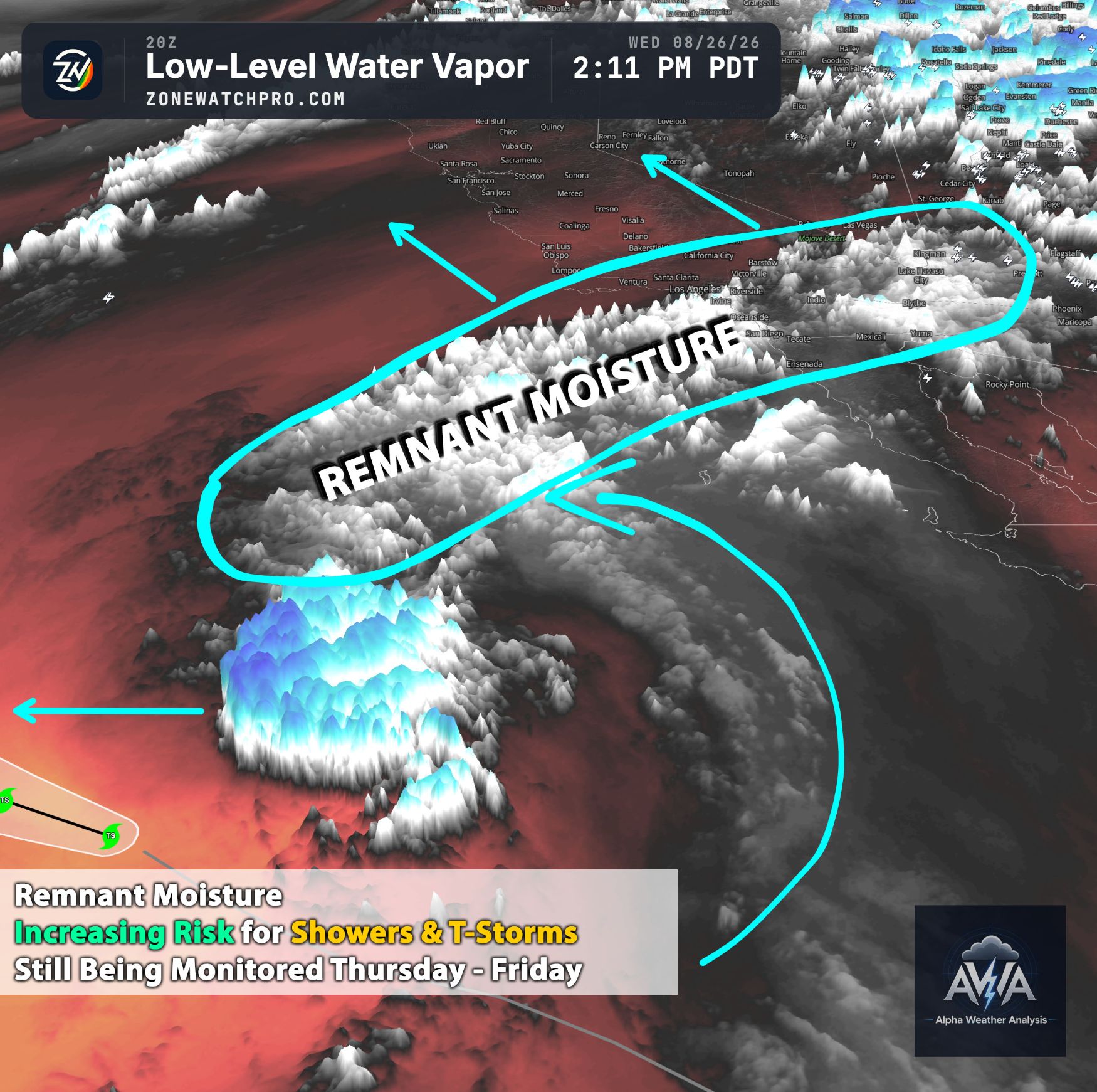
Usually, high pressure pushes these tropical systems due west into open ocean, but an approaching trough looks to exert significant influence, steering this tropical energy further north toward California.The big question remains: will it slam the coast as breathless headlines claim? The majority of models indicate the center will likely miss Southern California. However, due to enhanced atmospheric lift from that trough, remnant tropical moisture is expected to spread over Southern California regardless.
Looking at the two main scenarios, one is obviously much more extreme. If the storm core tracks closer, local rainfall totals could exceed what current models depict.
Even if that worst case track occurs, I still do not expect an actual hurricane to hit Southern California. The odds are essentially zero because our cold coastal waters act like a giant ice bucket, quickly sapping tropical strength. Could it arrive as a tropical storm? That is possible.
We saw that with Tropical Storm Hilary, which delivered significant rain, local flash flooding, and gusty winds, though still nothing comparable to the severe hurricane damage seen in the Southwest or the East Coast. You can also look at Hawaii for tropical comparisons.
We will continue monitoring this with zero bias as forecast confidence grows. Moisture will almost certainly reach Southern California and parts of Central California. How much rain falls and what wind speeds materialize are the lingering questions. We need a few more days for the weather pattern to solidify.
Until then, take sensational headlines with a large grain of salt, especially from sources chasing clicks over facts. If you live in a flood prone area, basic preparation makes sense if heavy rain develops. But there is no reason to panic over a hurricane hitting Southern California. That is simply not going to happen unless physics takes an unscheduled vacation.
A tropical storm, tropical depression, or post tropical remnant low is the true worst case scenario. Anyone promising a full hurricane is wandering deep into la la land.Stay tuned for more updates over the coming days as the forecast clears up.
We are watching this closely, and we will bring you the facts here at Alpha Weather Analysis.